| << Portugal: Amtliche topografische Landkarten des Instituto Geográfico do Exército (IGeoE) 1:25.000 (Serie M888) |
||
|
||

Zuletzt angesehene Artikel:
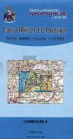
 | 217 - Topographische Landkarte Portugal 1:25.000 Carta Militar de Portugal - Série M888 Instituto Geográfico do Exército (IGeoE) - Portugal |
 | 645 Cabo Formentor - Mallorca Amtliche topographische Landkarte 1:50.000 Spanien (M.T.N.) 645 Mapa Topográfico Nacional de Espana (MTN50) Instituto Geográfico Nacional - CNIG Spanien |
 | 608 Tavira - Topographische Landkarte Portugal 1:25.000 Carta Militar de Portugal - Série M888 Instituto Geográfico do Exército (IGeoE) - Portugal |
 | 5908 Alf - Wanderkarte mit Wanderwegen (geplottete Ausgabe) ProjektNord - Grundlage Amtliche topographische Karte Landesamt für Vermessung und Geobasisinformation Rheinland-Pfalz |
 | 0761 LLANOS DEL CAUDILLO Topographische Landkarte 1:50.000 Spanien (Grundlage MTN50) Instituto Geográfico Nacional - CNIG Spanien - ProjektNord |
 | L-34-IV Debrecen Amtliche Topographische Landkarte Ungarn 1:200.000 |
 | C1930 Oldenburg in Holstein Topographische Landkarte 1:100.000 Landesvermessungsamt Schleswig-Holstein |
 | 227 - Topographische Landkarte Portugal 1:25.000 Carta Militar de Portugal - Série M888 Instituto Geográfico do Exército (IGeoE) - Portugal |
 | Glatzer Schneegebirge - Reichensteiner Gebirge - Bielengebirge - Zuckmanteler Bergland 1:50.000 Touristische Landkarte und Wanderkarte Polen Masyw Śnieżnika, Góry Złote, Góry Bialskie, Góry Opawskie CartoMedia (Sygnatura) Polen |
 | 940 (12-38) Castilblanco de los Arroyos Amtliche topographische Landkarte 1:50.000 Spanien (M.T.N.) 940 Mapa Topográfico Nacional de Espana (MTN50) Instituto Geográfico Nacional - CNIG Spanien |
 | L5504 Schleiden (geplottete Ausgabe) Amtliche topographische Karte 1:50.000 Landesvermessungsamt Nordrhein-Westfalen |
 | Emma und Max auf Ostseekurs - von Marlis Kahlsdorf - Boyens Buchverlag |
 | 2417-IV Læsø - mit Wanderwegen und Fahrradrouten Topographische Fahrradkarte und Wanderkarte Dänemark 1:50.000 - Kort & Matrikelstyrelsen ProjektNord 2417-IV Læsø - Topografisk Cykel- og Vandrekort Danmark |
 | Glogau und Fraustadt Kreiskarte des Deutschen Reiches 1:100.000 (KDR 100 KK) - Faksimile Reichsamt für Landesaufnahme |
 | 260 - Topographische Landkarte Portugal 1:25.000 Carta Militar de Portugal - Série M888 Instituto Geográfico do Exército (IGeoE) - Portugal |
 | 526 - PROVENÃA Topographische Landkarte Portugal 1:25.000 Carta Militar de Portugal - Série M888 Instituto Geográfico do Exército (IGeoE) - Portugal PROVENÃA |
 | 0805-4 CASTUERA Topographische Landkarte 1:25.000 Spanien (Grundlage MTN25) Instituto Geográfico Nacional - CNIG Spanien - ProjektNord |
 | W267 Stühlingen - Wanderkarte 1:25.000 Randen, Wutachtal, Schaffhausen - von LGL - Landesamt für Geoinformation und Landentwicklung Baden-Württemberg (LGL) |
 | Balkans & Peaks of the Balkans 1:55.000 / 1:1 Mio. Landkarte - ITMB International Travel Reference Maps (engl.) |
 | U4234 Ylläs Topographische Karte 1:25.000 EUREF (Peruskartta) Maanmittauslaitos / Lantmäteriverket Finnland - ProjektNord |