| << Portugal: Amtliche topografische Landkarten des Instituto Geográfico do Exército (IGeoE) 1:25.000 (Serie M888) |
||
|
||

Zuletzt angesehene Artikel:
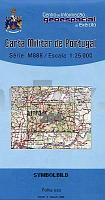
 | 204 - Topographische Landkarte Portugal 1:25.000 Carta Militar de Portugal - Série M888 Instituto Geográfico do Exército (IGeoE) - Portugal |
 | 792 Alpera Amtliche topographische Landkarte 1:50.000 Spanien (M.T.N.) 792 Mapa Topográfico Nacional de Espana (MTN50) Instituto Geográfico Nacional - CNIG Spanien |
 | 396 Bermillo de Sayago Amtliche topographische Landkarte 1:50.000 Spanien (M.T.N.) 396 Mapa Topográfico Nacional de Espana (MTN50) Instituto Geográfico Nacional - CNIG Spanien |
 | 4049-SO Topographische Karte 1:10.000 - Landesvermessungsamt Brandenburg |
 | Trentino Zwischen Gardasee, Etsch und Dolomiten, 550 km, 75.000, GPS-Tracks, LiveUpdate - von Esterbauer Verlag |
 | 0333-2 SALT Topographische Landkarte 1:25.000 Spanien (Grundlage MTN25) Instituto Geográfico Nacional - CNIG Spanien - ProjektNord |
 | 673 Illa de l´Aire - Menorca Amtliche topographische Landkarte 1:50.000 Spanien (M.T.N.) 673 Mapa Topográfico Nacional de Espana (MTN50) Instituto Geográfico Nacional - CNIG Spanien |
 | 4144 Linda Sonderausgabe mit Wanderwegen - Topographische Wanderkarte Brandenburg 1:25.000 ProjektNord |
 | 487 Ledanca Amtliche topographische Landkarte 1:50.000 Spanien (M.T.N.) 487 Mapa Topográfico Nacional de Espana (MTN50) Instituto Geográfico Nacional - CNIG Spanien |
 | Kejser Franz Joseph Fjord / Ella à - Daneborg (Blatt 12) 1:500.000 VIKING Polar Cruise Series Topographische Landkarte Saga Maps Grönland |
 | 601 Navalcán Amtliche topographische Landkarte 1:50.000 Spanien (M.T.N.) 601 Mapa Topográfico Nacional de Espana (MTN50) Instituto Geográfico Nacional - CNIG Spanien |
| 1216-IV Løgstør Topographische Karte Dänemark 1:50.000 Kort & Matrikelstyrelsen / Geodætisk Institut |
 | 2112-IV Sønderho - mit Wanderwegen und Fahrradrouten Topographische Fahrradkarte und Wanderkarte Dänemark 1:50.000 - Kort & Matrikelstyrelsen ProjektNord 2112-IV Sønderho - Topografisk Cykel- og Vandrekort Danmark |
| CC 3934 Magdeburg Bodenübersichtskarte 1:200.000 - Bundesanstalt für Geowissenschaften und Rohstoffe (BGR) |
 | 0423-2 VILLAR DEL BUEY Topographische Landkarte 1:25.000 Spanien (Grundlage MTN25) Instituto Geográfico Nacional - CNIG Spanien - ProjektNord |
 | 3851 Breeskow Sonderausgabe mit Wanderwegen - Topographische Wanderkarte Brandenburg 1:25.000 ProjektNord |
| 474 La Fregeneda Amtliche topographische Landkarte 1:50.000 Spanien (M.T.N.) 474 Mapa Topográfico Nacional de Espana (MTN50) Instituto Geográfico Nacional - CNIG Spanien |
 | 6314 Kirchheimbolanden - Wanderkarte mit Wanderwegen (geplottete Ausgabe) ProjektNord - Grundlage Amtliche topographische Karte Landesamt für Vermessung und Geobasisinformation Rheinland-Pfalz |
 | 140 - Topographische Landkarte Portugal 1:25.000 Carta Militar de Portugal - Série M888 Instituto Geográfico do Exército (IGeoE) - Portugal |
 | Parco Nazionale dello Stelvio - Carta 3 - Valcamonica - Passo Gavia e Val di Rezzalo - Topographische Wanderkarte 1:25.000 Ingenia Editori - Italien |