| << Portugal: Amtliche topografische Landkarten des Instituto Geográfico do Exército (IGeoE) 1:25.000 (Serie M888) |
||
|
||

Zuletzt angesehene Artikel:
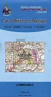
 | 183 - Topographische Landkarte Portugal 1:25.000 Carta Militar de Portugal - Série M888 Instituto Geográfico do Exército (IGeoE) - Portugal |
 | 3643 08+4621 05 Salmivaara Topographische Karte 1:20.000 (Maastokartta / Peruskartta / Grundkarta) Maanmittauslaitos / Lantmäteriverket Finnland - ProjektNord |
 | 3123 05 Koirakivi Topographische Karte 1:20.000 (Maastokartta / Peruskartta / Grundkarta) Maanmittauslaitos / Lantmäteriverket Finnland - ProjektNord |
 | Woiwodschaft Ermland-Masuren Landkarte 1:250.000 Touristische Landkarte Warmińsko-mazurskie - podróżownik Demart - Polen |
 | 1131 05 Kammela Topographische Karte 1:20.000 (Maastokartta / Peruskartta / Grundkarta) Maanmittauslaitos / Lantmäteriverket Finnland - ProjektNord |
 | 5240 Zwickau - Geologische Karte 1:25.000 (GK25 (N)) Grundlage Topographische Karte Sächsisches Landesamt für Umwelt, Landwirtschaft und Geologie |
 | 690-2 HONRUBIA Amtliche topographische Landkarte 1:25.000 Spanien (M.T.N.) 690-2 Mapa Topográfico Nacional de Espana (MTN25) Instituto Geográfico Nacional - CNIG Spanien |
 | 183-III Andorra la Vella Amtliche topographische Landkarte 1:25.000 Spanien (M.T.N.) 183-III Mapa Topográfico Nacional de Espana (MTN25) Instituto Geográfico Nacional - CNIG Spanien |
| Erläuterungen zur Geologischen Karte 5341 Kirchberg-Wildenfels (125) - Ausgabe 1900 Sächsisches Landesamt für Umwelt, Landwirtschaft und Geologie |
 | 2813 09 Keijarainen Topographische Karte 1:20.000 (Maastokartta / Peruskartta / Grundkarta) Maanmittauslaitos / Lantmäteriverket Finnland - ProjektNord |
 | Deutsch Kroner Seenplatte - Dramburger Seenplatte (polnisch) 1:160.000 Touristische Landkarte, Angelkarte, Wassersportkarte Mapa wędkarska Pojezierza Wałeckiego i Drawskiego EKO-Map - Polen |
 | 236 - Topographische Landkarte Portugal 1:25.000 Carta Militar de Portugal - Série M888 Instituto Geográfico do Exército (IGeoE) - Portugal |
 | 2041 02 Koisjärvi Topographische Karte 1:20.000 (Maastokartta / Peruskartta / Grundkarta) Maanmittauslaitos / Lantmäteriverket Finnland - ProjektNord |
 | 430 Oeiras Topographische Landkarte Wanderkarte und Fahrradkarte Portugal 1:25.000 430 Mapa topográfico - Mapa de caminhadas - Portugal 1:25.000 ProjektNord |
 | 526-3 SERRADILLA DEL ARROYO Amtliche topographische Landkarte 1:25.000 Spanien (M.T.N.) 526-3 Mapa Topográfico Nacional de Espana (MTN25) Instituto Geográfico Nacional - CNIG Spanien |
 | 5725 Stangenroth Topographische Landkarte Bayern 1:25.000 - Normalausgabe - ProjektNord (geplottete Ausgabe) - Grundlage amtliche Topographische Karte Bayern DTK25 |
 | 3644 09+4622 06 Kuoskuvaara Topographische Karte 1:20.000 (Maastokartta / Peruskartta / Grundkarta) Maanmittauslaitos / Lantmäteriverket Finnland - ProjektNord |
| Skjerstadfjorden - Rognan - Seekarte Norwegische Küste 1:50.000 - (Blatt 137) Den Norske Kyst Sjøkart - Hovedkart (sjø) Statens Kartverk Sjø - Norwegen |
 | 83 Vila Nova de Famalicao Topographische Landkarte Wanderkarte und Fahrradkarte Portugal 1:25.000 083 Mapa topográfico - Mapa de caminhadas - Portugal 1:25.000 ProjektNord |
 | 793-2 NAVALÃN Amtliche topographische Landkarte 1:25.000 Spanien (M.T.N.) 793-2 Mapa Topográfico Nacional de Espana (MTN25) Instituto Geográfico Nacional - CNIG Spanien |