Willkommen bei MapFox
Wurde Ihre Bestellung bestätigt? Wenn nicht - gab es evtl. ein SERVER-Problem! Bitte kontaktieren Sie uns! +++ Buchhändler-Anfragen erwünscht +++
Warenkorb
Artikel: 0 - € 0.00
Zur Kasse
Impressum Kontakt Versandkosten AGB
137 Lamego - Topographische Landkarte Portugal 1:25.000 Carta Militar de Portugal - Série M888 Instituto Geográfico do Exército (IGeoE) - Portugal
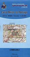
<< Portugal: Amtliche topografische Landkarten des Instituto Geográfico do Exército (IGeoE) 1:25.000 (Serie M888)
 
Cover

Gesamtliste mit Blattübersicht

Kartenbeispiel aus der Serie

Kartenausschnitt

137 Lamego - Topographische Landkarte Portugal 1:25.000 Carta Militar de Portugal - Série M888 Instituto Geográfico do Exército (IGeoE) - Portugal
Preis: EUR 17.90

Bestellartikel: versandfertig in ca. 2 Wochen oder länger. Dieser Artikel wird speziell für Sie bestellt. Keine Rücknahme!
Produkt EUR Anzahl Bestellen
137 Lamego - Topographische Landkarte Portugal 1:25.000 Carta Militar de Portugal - Série M888 Instituto Geográfico do Exército (IGeoE) - Portugal 17.90
Versandkostenfrei in Deutschland ab 30,- Bestellwert

incl. MwSt.

Stichworte, die bei der Suche nützlich sein könnten:
Lamego topographische Karte - Lamego Landkarte - Lamego - Portugal - topografische Wanderkarten - Serie M888 - Série M888 - M888

Zuletzt angesehene Artikel:

Cover137 Lamego - Topographische Landkarte Portugal 1:25.000 Carta Militar de Portugal - Série M888 Instituto Geográfico do Exército (IGeoE) - Portugal

CoverL2722 Sittensen (geplottete Ausgabe) Topographische Karte 1:50.000 Kartografie Landesvermessungsamt Niedersachsen - ProjektNord

Cover5730 Heldburg Topographische Landkarte Bayern 1:25.000 - Normalausgabe - ProjektNord (geplottete Ausgabe) - Grundlage amtliche Topographische Karte Bayern DTK25

CoverL2728 Lüneburg (geplottete Ausgabe) Topographische Karte 1:50.000 Kartografie Landesvermessungsamt Niedersachsen - ProjektNord

Cover3349 Prötzel Sonderausgabe mit Wanderwegen - Topographische Wanderkarte Brandenburg 1:25.000 ProjektNord

CoverVelence-See und Velence-Gebirge - Topographische Wanderkarte 1:25.000 - Stadtpläne Gárdony - Nadap - Pákozd - Sukoró - Velence 1:15.000
Velencei-tó - Velencei-hegység Szarvas - Kovacs - Ungarn

CoverWandern in Småland - Südostschweden

CoverMount Rainier Trail Map 1:100.000 - regionale Straßenkarte 1:225.000 (Washington - USA)
Mount Rainer Recreation & Surrounding Communities - road map The Map Company / GM Johnson

CoverWanderrouten in Ostgrönland - Ammassalik / Tasiilaq - 2 Wanderkarten Kuummiit und Tasiilaq 1:100.000 mit Wanderführer (Nr. 7) (deutsch, dänisch oder englisch) Wanderkarte Ostgrönland - Vandrekort Østgrønland - Udvalget for vandreturisme i Grønland - Greenland Tourism

CoverFreistaat Sachsen 1925 Spezialkarte - historische Landkarte (Nachdruck) - Pharus-Plan

Cover3442 Wachow Sonderausgabe mit Wanderwegen - Topographische Wanderkarte Brandenburg 1:25.000 ProjektNord

Cover565 - Topographische Landkarte Portugal 1:25.000 Carta Militar de Portugal - Série M888 Instituto Geográfico do Exército (IGeoE) - Portugal

Noch kein Cover vorhandenL4544 Torgau Topographische Karte 1:50.000 (Regelblattschnitt) Landesvermessungsamt Brandenburg

CoverU5132 Nousu Topographische Karte 1:25.000 EUREF (Peruskartta) Maanmittauslaitos / Lantmäteriverket Finnland - ProjektNord

Cover288 Bradford & Huddersfield - Wanderkarte Großbritannien 1:25.000 EXPLORER MAP - Ordnance Survey

Noch kein Cover vorhanden5150 Rosenthal-Bielatal Amtliche Topographische Landkarte 1:25.000 (Präsentationsgrafik) - Landesvermessungsamt Sachsen

CoverNovo Mesto Taschen-Stadtplan Kartografija - Slowenien 1:10.000

CoverROUTE DES GRANDES ALPES 1:220.000 Touristische Wanderkarte
ROUTE DES GRANDES ALPES - Découverte des chemins IGN Frankreich

CoverLa Dordogne - à vélo - Découverte à Vélo Touristische Karte 1:100.000 (wasserfest) IGN Frankreich

CoverDuMont direkt Reiseführer Málaga Mit großem Cityplan - von Blázquez, Manuel García - DuMont Reiseverlag