| << Portugal: Amtliche topografische Landkarten des Instituto Geográfico do Exército (IGeoE) 1:25.000 (Serie M888) |
||
|
||

Zuletzt angesehene Artikel:
 | 136 - Cinfães - Topographische Landkarte Portugal 1:25.000 Carta Militar de Portugal - Série M888 Instituto Geográfico do Exército (IGeoE) - Portugal |
 | 4509 Bochum (geplottete Ausgabe) Amtliche topographische Karte 1:25.000 Landesvermessungsamt Nordrhein-Westfalen |
 | 7436 Au Hallertau Topographische Landkarte Bayern 1:25.000 - Normalausgabe - ProjektNord (geplottete Ausgabe) - Grundlage amtliche Topographische Karte Bayern DTK25 |
 | Die Eider und das Land am Strom von Jürgen Rust - edition limosa |
 | Neapel Stadtplan 1:12.000 Napoli - Pianta della Citta L.A.C. GlobalMap Italien |
 | 200 Alpi Apuane 1:25.000 (extra wasser- und reiÃfest) Wander-und Mountainbikekarte - 4land Alpi Apuane - Carta Topografica Escursionistica |
 | Island InselTrip Reiseführer mit Insel-Faltplan und kostenloser Web-App - von Alexander Schwarz - Reise Know-How |
 | Mosel - Region Trier (Nr. 834) 1:50.000 - Wanderkarte mit Broschüre KOMPASS |
 | 6832 Heideck Topographische Landkarte Bayern 1:25.000 - Normalausgabe - ProjektNord (geplottete Ausgabe) - Grundlage amtliche Topographische Karte Bayern DTK25 |
 | Mecklenburg-Vorpommern 1:125:000 (Nr. 3702) *** SCHNÃPPCHEN *** GroÃraum-Radtourenkarte - KOMPASS-Karten |
 | 333.2 Amtliche topographische Karte 1:50.000 Polen |
 | 3553 Lebus Sonderausgabe mit Wanderwegen - Topographische Wanderkarte Brandenburg 1:25.000 ProjektNord |
 | Jalhay 1:25.000 - 15 Wanderungen & 4 MTB-Touren Touristische Wanderkarte und Mountainbikekarte Belgien NGI Belgien |
 | 23 Merzouga - Alnif - Tazzarine Topographische StraÃenkarte 1:250.000 - Marokko ProjektNord |
 | Pacific Northwest`s Best Trips Reiseführer Lonely Planet (engl.) |
| 3861 Köbnitz Topographische Karte 1:25.000 Messtischblatt des Deutschen Reiches - PreuÃische Landesaufnahme / Reichsamt für Landesaufnahme - Faksimile ProjektNord |
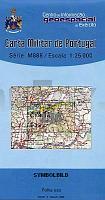
 | 484 - Topographische Landkarte Portugal 1:25.000 Carta Militar de Portugal - Série M888 Instituto Geográfico do Exército (IGeoE) - Portugal |
 | Q5423 Lentuankylä Topographische Karte 1:25.000 EUREF (Peruskartta) Maanmittauslaitos / Lantmäteriverket Finnland - ProjektNord |
 | 2109 (NL 32-06-09) Schlanders Topographische Wanderkarte 1:50.000 mit Wegmarkierungen - Ãsterreich - Kartographie BEV - ProjektNord |
 | Jasper North 1:100.000 (Blatt 903) Landkarte - Trails Illustrated Map - National Parks USA National Geographic |