| << Portugal: Amtliche topografische Landkarten des Instituto Geográfico do Exército (IGeoE) 1:25.000 (Serie M888) |
||
|
||

Zuletzt angesehene Artikel:
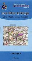
 | 120 - Topographische Landkarte Portugal 1:25.000 Carta Militar de Portugal - Série M888 Instituto Geográfico do Exército (IGeoE) - Portugal |
 | 602 Navamorcuende Amtliche topographische Landkarte 1:50.000 Spanien (M.T.N.) 602 Mapa Topográfico Nacional de Espana (MTN50) Instituto Geográfico Nacional - CNIG Spanien |
 | 480 Fontiveros Amtliche topographische Landkarte 1:50.000 Spanien (M.T.N.) 480 Mapa Topográfico Nacional de Espana (MTN50) Instituto Geográfico Nacional - CNIG Spanien |
 | 105K01 - Tenas Creek Topographische Landkarte 1:50.000 - Canada - Yukon |
 | 4423 Oedelsheim - Wanderkarte mit Wanderwegen (geplottete Ausgabe) Topographische Landkarte Hessen 1:25.000 - ProjektNord (geplottete Ausgabe) |
 | Schlei - 22 Wanderungen - (Band 355) *** SCHNÃPPCHEN *** Outdoor Regional - GPS-Tracks zum Download - von Michael Hennemann - Conrad-Stein-Verlag |
 | Nordost-Island und Ost-Island (Blatt 3) *** SCHNÃPPCHEN *** - Touristische Landkarte 1:250.000 Norðaustur- og Austurland ferðakort 3 Landmælingar - Island |
 | 719 Venta del Moro Amtliche topographische Landkarte 1:50.000 Spanien (M.T.N.) 719 Mapa Topográfico Nacional de Espana (MTN50) Instituto Geográfico Nacional - CNIG Spanien |
 | 657 Sonseca Amtliche topographische Landkarte 1:50.000 Spanien (M.T.N.) 657 Mapa Topográfico Nacional de Espana (MTN50) Instituto Geográfico Nacional - CNIG Spanien |
 | 282 Topographische Landkarte Wanderkarte und Fahrradkarte Portugal 1:25.000 282 Mapa topográfico - Mapa de caminhadas - Portugal 1:25.000 ProjektNord |
 | 6616 Speyer - Wanderkarte mit Wanderwegen (geplottete Ausgabe) ProjektNord - Grundlage Amtliche topographische Karte Landesamt für Vermessung und Geobasisinformation Rheinland-Pfalz |
 | 211 Ervedal da Beira (Oliveira do Hospital) Topographische Landkarte Wanderkarte und Fahrradkarte Portugal 1:25.000 211 Mapa topográfico - Mapa de caminhadas - Portugal 1:25.000 ProjektNord |
 | 2114-II-Nà Topographische Karte Dänemark 1:25.000 Topografisk kort Danmark (DTK/Kort25) 2114-II-Nà ProjektNord - Kort & Matrikelstyrelsen / Geodætisk Institut |
 | 0432-1 RIAZA Topographische Landkarte 1:25.000 Spanien (Grundlage MTN25) Instituto Geográfico Nacional - CNIG Spanien - ProjektNord |
 | C6334 Bayreuth Topographische Karte 1:100.000 - ProjektNord - Kartographie Bayrisches Landesvermessungsamt |
 | 0767 CARCELÃN Topographische Landkarte 1:50.000 Spanien (Grundlage MTN50) Instituto Geográfico Nacional - CNIG Spanien - ProjektNord |
 | 723 Isergebirge 1:25.000 Wanderkarte/Radwanderkarete - SHOCart - Tschechien Jizerské hory |
| 4145-SO Topographische Karte 1:10.000 - Landesvermessungsamt Brandenburg |
 | 159 (11-09) - Bembibre Amtliche topographische Landkarte 1:50.000 Spanien (M.T.N.) 159 Mapa Topográfico Nacional de Espana (MTN50) Instituto Geográfico Nacional - CNIG Spanien |
 | M15 Neumarkt - St. Veit - mit Gangkofen, Vilsbiburg, Bodenkirchen, Massing, Egglkofen, Niedertaufkirchen *** SCHNÃPPCHEN *** ATK25 Topographische Karte 1:25.000 (Atkis) Bayern Landesvermessungsamt Bayern - Wanderkarte |