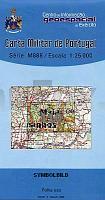
| << Portugal: Amtliche topografische Landkarten des Instituto Geográfico do Exército (IGeoE) 1:25.000 (Serie M888) |
||
|
||

Zuletzt angesehene Artikel:
 | 110 - Maja Topographische Landkarte Portugal 1:25.000 Carta Militar de Portugal - Série M888 Instituto Geográfico do Exército (IGeoE) - Portugal |
 | Mit dem Fahrrad über alte Bahntrassen im Ruhrgebiet Die schönsten Touren auf stillgelegten Strecken - Inklusive kostenloser GPS-Daten zum Download - von Uwe Ziebold und Christiane Ziebold - Bachem, J P |
 | Stadtplan Tjumen 1:25.000 Stadtplan - Russland Тюмень. Карта города. Rus Co. Ltd. |
 | Böhmisches Mittelgebirge Ost (Verneřice) (Blatt 78) - Topographische Wanderkarte 1:25.000 Geodezie On Line - Tschechien České středohořà - Litoměřické středohořà - Porta Bohemica, úštěcká pahorkatina - Verneřické středohořà |
 | SENDER DE LA MEDITERRÃNIA Touristischer Wanderführer - Wanderkarte 1:50.000 GR 92 SUD De Vallvidrera (Barcelona) al Pont de Moliner (Ulldecona) Editorial Alpina Spanien |
 | E13 Grafenwöhr - Kemnath - Pressath - Krummennaab - Schwarzenbach - Parkstein ATK25 Topographische Karte 1:25.000 (Atkis) Bayern Landesvermessungsamt Bayern - Wanderkarte |
 | 968 Alcaudete Amtliche topographische Landkarte 1:50.000 Spanien (M.T.N.) 968 Mapa Topográfico Nacional de Espana (MTN50) Instituto Geográfico Nacional - CNIG Spanien |
 | Hohe Eifel, Ahrtal, Mosel, von Koblenz bis Trier 1:70.000 (Nr. 3338) Fahrradkarte - reiÃ- und wetterfest mit Extra Stadtplänen - von KOMPASS-Karten GmbH |
 | G09 Nürnberg mit Fürth, Heroldsberg, Oberasbach, Stein, Wendelstein, Zirndorf ATK25 Topographische Karte 1:25.000 (Atkis) Bayern Landesvermessungsamt Bayern - Wanderkarte - Radwanderkarte |
 | 12. Rhein-Maas-Delta 1:50.000 - Wassersportkarte / Gewässerkarte Hollandse Delta - ANWB Waterkaart ANWB - Niederlande |
 | Historische Karte: ÃRMELKANAL - Südliches ENGLAND und nördliches FRANKREICH - KANALINSELN - um 1710 - Historische Landkarte Tabula nova complectens Praefecturas Normanniae et Britanniae, una cum Angliae, parte et Manica cum Privil. Ord. Gen. Belgii Foederati - von Visscher, Nicolaes (Kartogr.) Schenk, Peter der Jüngere - Verlag Rockstuhl |
 | Starnberger See - Ammersee (Nr. 180) 4in1 Wanderkarte 1:50.000 mit Aktiv Guide und Detailkarten inklusive Karte zur offline Verwendung in der KOMPASS-App. Fahrradfahren. - von KOMPASS-Karten |
 | 4006 Oeding (geplottete Ausgabe) Amtliche topographische Karte 1:25.000 Landesvermessungsamt Nordrhein-Westfalen |
 | 0832 MONTERRUBIO DE LA SERENA Topographische Landkarte 1:50.000 Spanien (Grundlage MTN50) Instituto Geográfico Nacional - CNIG Spanien - ProjektNord |
 | 3 Jütland Ost - Anholt - Fahrradkarte Dänemark 1:100.000 - zweiseitig - wasserfest Auf Basis der topographischen Karte Dänemark - ProjektNord |
 | E10 Ebermannstadt - mit GöÃweinstein, Waischenfeld, Wiesenttal, Pottenstein, Pretzfeld, Heiligenstadt i.OFr. ATK25 Topographische Karte 1:25.000 (Atkis) Bayern Landesvermessungsamt Bayern - Wanderkarte |
 | 1077-IV Tarifa Amtliche topographische Landkarte 1:25.000 Spanien (M.T.N.) 1077-IV Mapa Topográfico Nacional de Espana (MTN25) Instituto Geográfico Nacional - CNIG Spanien |
 | 5024 Neuchâtel - Les Verrières - La Neuveville 1:50.000 Zusammensetzung Topographische Landeskarte der Schweiz - swisstopo |
 | 932 Coy Amtliche topographische Landkarte 1:50.000 Spanien (M.T.N.) 932 Mapa Topográfico Nacional de Espana (MTN50) Instituto Geográfico Nacional - CNIG Spanien |
 | 1036-II Olvera Amtliche topographische Landkarte 1:25.000 Spanien (M.T.N.) 1036-II Mapa Topográfico Nacional de Espana (MTN25) Instituto Geográfico Nacional - CNIG Spanien |