| << Portugal: Amtliche topografische Landkarten des Instituto Geográfico do Exército (IGeoE) 1:25.000 (Serie M888) |
||
|
||

Zuletzt angesehene Artikel:
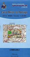
 | 84 - Topographische Landkarte Portugal 1:25.000 Carta Militar de Portugal - Série M888 Instituto Geográfico do Exército (IGeoE) - Portugal |
 | 4452-SO Topographische Karte 1:10.000 - Landesvermessungsamt Brandenburg |
 | 743 Madrigueras Amtliche topographische Landkarte 1:50.000 Spanien (M.T.N.) 743 Mapa Topográfico Nacional de Espana (MTN50) Instituto Geográfico Nacional - CNIG Spanien |
 | 337 Peniche Topographische Landkarte Wanderkarte und Fahrradkarte Portugal 1:25.000 337 Mapa topográfico - Mapa de caminhadas - Portugal 1:25.000 ProjektNord |
 | 6104 Bollendorf - Wanderkarte mit Wanderwegen (geplottete Ausgabe) ProjektNord - Grundlage Amtliche topographische Karte Landesamt für Vermessung und Geobasisinformation Rheinland-Pfalz |
 | 89 Tolosa Amtliche topographische Landkarte 1:50.000 Spanien (M.T.N.) 89 Mapa Topográfico Nacional de Espana (MTN50) Instituto Geográfico Nacional - CNIG Spanien |
 | 5810 Dommershausen - Wanderkarte mit Wanderwegen (geplottete Ausgabe) ProjektNord - Grundlage Amtliche topographische Karte Landesamt für Vermessung und Geobasisinformation Rheinland-Pfalz |
 | 190 O Barco Amtliche topographische Landkarte 1:50.000 Spanien (M.T.N.) 190 Mapa Topográfico Nacional de Espana (MTN50) Instituto Geográfico Nacional - CNIG Spanien |
 | 97 (07-07) GuntÃn Amtliche topographische Landkarte 1:50.000 Spanien (M.T.N.) 97 (07-07) Mapa Topográfico Nacional de Espana (MTN50) Instituto Geográfico Nacional - CNIG Spanien |
 | 2314-II-Sà Topographische Karte Dänemark 1:25.000 Topografisk kort Danmark (DTK/Kort25) 2314-II-Sà ProjektNord - Kort & Matrikelstyrelsen / Geodætisk Institut |
 | 2514-II Hillerød - mit Wanderwegen und Fahrradrouten Topographische Fahrradkarte und Wanderkarte Dänemark 1:50.000 - Kort & Matrikelstyrelsen ProjektNord 2514-II Hillerød - Topografisk Cykel- og Vandrekort Danmark |
| 4352-NO Topographische Karte 1:10.000 - Landesvermessungsamt Brandenburg |
 | 0189 A POBRA DE TRIVES Topographische Landkarte 1:50.000 Spanien (Grundlage MTN50) Instituto Geográfico Nacional - CNIG Spanien - ProjektNord |
| 20 II Topographische Landkarte Portugal 1:50.000 Carta Militar de Portugal Instituto Geográfico do Exército (IGeoE) - Portugal |
 | 0334-3 CASSà DE LA SELVA Topographische Landkarte 1:25.000 Spanien (Grundlage MTN25) Instituto Geográfico Nacional - CNIG Spanien - ProjektNord |
 | L3120 Verden (Aller) (geplottete Ausgabe) Topographische Karte 1:50.000 Kartografie Landesvermessungsamt Niedersachsen - ProjektNord |
 | 490 Topographische Landkarte Wanderkarte und Fahrradkarte Portugal 1:25.000 490 Mapa topográfico - Mapa de caminhadas - Portugal 1:25.000 ProjektNord |
 | 298 - Olival (Ourém) Topographische Landkarte Portugal 1:25.000 Carta Militar de Portugal - Série M888 Instituto Geográfico do Exército (IGeoE) - Portugal |
 | 5905 Kyllburg - Wanderkarte mit Wanderwegen (geplottete Ausgabe) ProjektNord - Grundlage Amtliche topographische Karte Landesamt für Vermessung und Geobasisinformation Rheinland-Pfalz |
 | 6714 Edenkoben - Wanderkarte mit Wanderwegen (geplottete Ausgabe) ProjektNord - Grundlage Amtliche topographische Karte Landesamt für Vermessung und Geobasisinformation Rheinland-Pfalz |