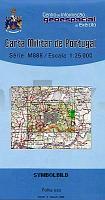
| << Portugal: Amtliche topografische Landkarten des Instituto Geográfico do Exército (IGeoE) 1:25.000 (Serie M888) |
||
|
||

Zuletzt angesehene Artikel:
 | 83 Vila Nova de Famalicao - Topographische Landkarte Portugal 1:25.000 Carta Militar de Portugal - Série M888 Instituto Geográfico do Exército (IGeoE) - Portugal |
 | 23J SV NORSJà 1:50.000 *** SCHNÃPPCHEN *** Topographische Wanderkarte Schweden (Terrängkarta/Gröna Kartan) - Kartförlaget - Lantmäteriet Landkarte Schweden |
 | 5/1 Karwendelgebirge - Westliches Blatt - Wegmarkierungen Wanderkarte Alpenvereinskarte Ãsterreich 1:25.000 - Deutscher Alpenverein |
| 1732 Grube - Dahme - Gestern und Heute - Historische Ãberlagerung 1953-1956 Topographische Landkarte 1:25.000 im Vergleich - Landesvermessungsamt Schleswig-Holstein / ProjektNord |
| 1832 Kellenhusen - Gestern und Heute - Historische Ãberlagerung 1953-1956 Topographische Landkarte 1:25.000 im Vergleich - Landesvermessungsamt Schleswig-Holstein / ProjektNord |
 | 4 Norra Svealand / Södra Norrland *** SCHNÃPPCHEN *** StraÃenkarte 1:250.000 Landkarte Kartförlaget Schweden |
 | USA - Canada - Mexico - Autoatlas 1:400.000 - 1:16 Mio. (aktuelle Jahresausgabe) StraÃenatlas mit Spiralbindung, besonders gut lesbar - Freytag-Berndt und ARTARIA |
 | 7543 Pfarrkirchen Topographische Landkarte Bayern 1:25.000 - Normalausgabe - ProjektNord (geplottete Ausgabe) - Grundlage amtliche Topographische Karte Bayern DTK25 |
 | Der Kohlenwald und Umgebung *** SCHNÃPPCHEN *** Touristische Wanderkarte mit Wanderführer (frz./fläm./dt.) Belgien NGI Belgien La Forêt de Soignes et ses alentours - Het Zoniënwoud en zijn omgeving - |
 | 913 (27-36) Orihuela Amtliche topographische Landkarte 1:50.000 Spanien (M.T.N.) 913 Orihuela Mapa Topográfico Nacional de Espana (MTN50) Instituto Geográfico Nacional - CNIG Spanien |
 | Königreich HANNOVER, 1865 - Historische Landkarte Nachdruck Planokarte - gerollt - von H. Kiepert u. C. Ohmann. Revidiert von C. Gräf - Verlag Rockstuhl |
 | Mecklenburg-Vorpommern, Motorradkarte 1:250.000, freytag & berndt Toureninfos, GPX Tracks, wasserfest und reiÃfest - von freytag & berndt - Freytag-Berndt und ARTARIA |
 | Insel Fehmarn, Heiligenhafen und Umgebung 1:35.000 (Nr. 256) Rad- und Wanderkarte - Ausflüge auf der Insel Fehmarn und dem Gebiet zwischen Oldenburg in Holstein, Gremersdorf und der Ostseeküste - Dr. Barthel Verlag |
 | 02E OOSTERDUINEN Topographische Karte der Niederlande 1:25.000 (Plotausgabe) 02E OOSTERDUINEN Topografische Kaart van Nederland Kadaster - ProjektNord |
 | 1086 Corralejo - Fuerteventura Amtliche topographische Landkarte 1:50.000 Spanien (M.T.N.) 1086 Mapa Topográfico Nacional de Espana (MTN50) Instituto Geográfico Nacional - CNIG Spanien |
 | Kartenset `Bike Arena Sauerland` 1:35.000 (wetterfest) Mountainbikekarten-Set Nordrhein-Westfalen KKV - Kartographische Kommunale Verlagsgesellschaft |
 | Venetien - Trentino-Südtirol - Friaul-Julisch Venetien 1:250.000 - StraÃenkarte Italien Tre Venezie - Veneto - Trentino-Alto Adige/Südtirol - Friuli-Venezia Giulia Libreria Geografica - Italien |
 | München - Regensburg - Prag Leporello Radtourenkarte mit Ausflugszielen, Einkehr- & Freizeittipps, wetterfest, reiÃfest, abwischbar, GPS-genau. 1:50000 - von - Freytag-Berndt und ARTARIA Publicpress |
 | Alpi Apuane - Topographische Wanderkarte 1:25.000 (Blatt 101-102) - Versante della Lunigiana - Garfagnana - Versilia - Media Valle del Serchio - Edizioni Multigraphic - Italien Carta dei sentieri delle Alpi Apuan |
 | 1098 Las Palmas de Gran Canaria - Gran Canaria Amtliche topographische Landkarte 1:50.000 Spanien (M.T.N.) 1098 Mapa Topográfico Nacional de Espana (MTN50) Instituto Geográfico Nacional - CNIG Spanien |