| << Portugal: Amtliche topografische Landkarten des Instituto Geográfico do Exército (IGeoE) 1:25.000 (Serie M888) |
||
|
||

Zuletzt angesehene Artikel:
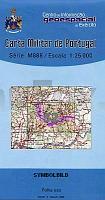
 | 52 - Topographische Landkarte Portugal 1:25.000 Carta Militar de Portugal - Série M888 Instituto Geográfico do Exército (IGeoE) - Portugal |
 | 153 - Topographische Landkarte Portugal 1:25.000 Carta Militar de Portugal - Série M888 Instituto Geográfico do Exército (IGeoE) - Portugal |
 | Antarktis und Provinz Feuerland 1:7 Mio. / 1:750.000 Falkland Island (Islas Malvinas) - Ushuaia - Landkarte - ITMB International Travel Maps (engl.) Antarctica & Tierra del Fuego |
 | 200 - Topographische Landkarte Portugal 1:25.000 Carta Militar de Portugal - Série M888 Instituto Geográfico do Exército (IGeoE) - Portugal |
 | 2314-I Ebeltoft - mit Wanderwegen und Fahrradrouten Topographische Fahrradkarte und Wanderkarte Dänemark 1:50.000 - Kort & Matrikelstyrelsen ProjektNord 2314-I Ebeltoft - Topografisk Cykel- og Vandrekort Danmark |
 | Elfenbeinküste - Reiseführer Afrika - Petit Futé Country Guides (franz.) Cote d’Ivore |
 | 6015 Mainz - Wanderkarte mit Wanderwegen (geplottete Ausgabe) ProjektNord - Grundlage Amtliche topographische Karte Landesamt für Vermessung und Geobasisinformation Rheinland-Pfalz |
 | L38-4-C Darganow 1:50.000 - Amtliche Topographische Karte der Russischen Föderation |
 | 170 - Topographische Landkarte Portugal 1:25.000 Carta Militar de Portugal - Série M888 Instituto Geográfico do Exército (IGeoE) - Portugal |
 | 367 de Alcañices Amtliche topographische Landkarte 1:50.000 Spanien (M.T.N.) 367 Mapa Topográfico Nacional de Espana (MTN50) Instituto Geográfico Nacional - CNIG Spanien |
 | 290 - Sobreira Formosa (Proenca-A-Nova) Topographische Landkarte Portugal 1:25.000 Carta Militar de Portugal - Série M888 Instituto Geográfico do Exército (IGeoE) - Portugal |
 | 0244-1 MARCILLA Topographische Landkarte 1:25.000 Spanien (Grundlage MTN25) Instituto Geográfico Nacional - CNIG Spanien - ProjektNord |
 | Siena - Volterra - Massa Marittima - Rocca Strada - San Galgano (Blatt 2462) Wanderkarte mit Kurzführer und Radrouten. GPS-genau. 1:50.000 - KOMPASS-Karten |
 | 121 - Topographische Landkarte Portugal 1:25.000 Carta Militar de Portugal - Série M888 Instituto Geográfico do Exército (IGeoE) - Portugal |
 | 3551 Heinersdorf Sonderausgabe mit Wanderwegen - Topographische Wanderkarte Brandenburg 1:25.000 ProjektNord |
 | 2514-I Helsingør - mit Wanderwegen und Fahrradrouten Topographische Fahrradkarte und Wanderkarte Dänemark 1:50.000 - Kort & Matrikelstyrelsen ProjektNord 2514-I Helsingør - Topografisk Cykel- og Vandrekort Danmark |
| NJ 38-1 Agri Amtliche Topographische Karte der Türkei 1:250.000 NJ 38-1 Ağri - Müşterek Harekat Haritası HGK |
 | 6120 Obernburg am Main Topographische Landkarte Bayern 1:25.000 - Normalausgabe - ProjektNord (geplottete Ausgabe) - Grundlage amtliche Topographische Karte Bayern DTK25 |
 | 3850 Kossenblatt Sonderausgabe mit Wanderwegen - Topographische Wanderkarte Brandenburg 1:25.000 ProjektNord |
 | Lorraine - Michelin Le Guide Vert (französisch) - Michelin |