| << Portugal: Amtliche topografische Landkarten des Instituto Geográfico do Exército (IGeoE) 1:25.000 (Serie M888) |
||
|
||

Zuletzt angesehene Artikel:
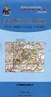
 | 36 - Topographische Landkarte Portugal 1:25.000 Carta Militar de Portugal - Série M888 Instituto Geográfico do Exército (IGeoE) - Portugal |
 | 3524 05 Toljanjärvi Topographische Karte 1:20.000 (Maastokartta / Peruskartta / Grundkarta) Maanmittauslaitos / Lantmäteriverket Finnland - ProjektNord |
 | Metropolia Silesia und Umgebung - Oberschlesische Industrieregion 1:50.000 - 101 touristische Attraktionen Polen Metropolia Silesia i okolice - 101 atrakcji turystycznych Compass - Polen |
 | 1143 01 Leistilänjärvi Topographische Karte 1:20.000 (Maastokartta / Peruskartta / Grundkarta) Maanmittauslaitos / Lantmäteriverket Finnland - ProjektNord |
 | 3412 11 Kurranjärvi Topographische Karte 1:20.000 (Maastokartta / Peruskartta / Grundkarta) Maanmittauslaitos / Lantmäteriverket Finnland - ProjektNord |
 | 294-4 SANTA MARIA DE CORCà Amtliche topographische Landkarte 1:25.000 Spanien (M.T.N.) 294-4 Mapa Topográfico Nacional de Espana (MTN25) Instituto Geográfico Nacional - CNIG Spanien |
 | Erläuterungen zur Geologischen Karte 5048 Kreischa (82) - Ausgabe 1912 Sächsisches Landesamt für Umwelt, Landwirtschaft und Geologie |
 | 278-1 Canales de la Sierra Amtliche topographische Landkarte 1:25.000 Spanien (M.T.N.) 278-1 Mapa Topográfico Nacional de Espana (MTN25) Instituto Geográfico Nacional - CNIG Spanien |
 | BundeswasserstraÃenkarte 1:1 Mio. (gefaltet - aktuelle Ausgabe) Gliederung der WasserstraÃen- und Schifffahrtsverwaltung des Bundes - Bundesministerium für Digitales und Verkehr |
 | 223-2 REDONDELA Amtliche topographische Landkarte 1:25.000 Spanien (M.T.N.) 223-2 Mapa Topográfico Nacional de Espana (MTN25) Instituto Geográfico Nacional - CNIG Spanien |
 | Oblast Schytomyr / Schitomir 1:250.000 Landkarte, StraÃenkarte mit administrativen Grenzen - Ukraine Schytomyrska oblast / Житомирська область Kartografija - ukrmap Ukraine |
 | 433 - Topographische Landkarte Portugal 1:25.000 Carta Militar de Portugal - Série M888 Instituto Geográfico do Exército (IGeoE) - Portugal |
| Sørfolda - Seekarte Norwegische Küste 1:50.000 - (Blatt 139) Den Norske Kyst Sjøkart - Hovedkart (sjø) Statens Kartverk Sjø - Norwegen |
 | 3841 11 Varttasaari Topographische Karte 1:20.000 (Maastokartta / Peruskartta / Grundkarta) Maanmittauslaitos / Lantmäteriverket Finnland - ProjektNord |
 | Böhmerwald - Eisenstein 1:25.000 (Blatt 117) Bayerisch Eisenstein - Bodenmais - Hojsova Stráž Janovice nad Ãhlavou - Lam - Nýrsko - Železná Ruda - Topographische Wanderkarte 1:25.000 Šumava - Železnorudsko Geodezie On Line - Tschechien |