| << Portugal: Amtliche topografische Landkarten des Instituto Geográfico do Exército (IGeoE) 1:25.000 (Serie M888) |
||
|
||

Zuletzt angesehene Artikel:
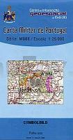
 | 9-A - Topographische Landkarte Portugal 1:25.000 Carta Militar de Portugal - Série M888 Instituto Geográfico do Exército (IGeoE) - Portugal |
 | 354-I (53-27) Alagón Amtliche topographische Landkarte 1:25.000 Spanien (M.T.N.) 354-I Mapa Topográfico Nacional de Espana (MTN25) Instituto Geográfico Nacional - CNIG Spanien |
 | 3713 10 Aihkipalonaapa Topographische Karte 1:20.000 (Maastokartta / Peruskartta / Grundkarta) Maanmittauslaitos / Lantmäteriverket Finnland - ProjektNord |
 | 3341 09 Sonkajärvi Topographische Karte 1:20.000 (Maastokartta / Peruskartta / Grundkarta) Maanmittauslaitos / Lantmäteriverket Finnland - ProjektNord |
 | 713-2 LAGUNAS DE VILLAFRANCA Amtliche topographische Landkarte 1:25.000 Spanien (M.T.N.) 713-2 Mapa Topográfico Nacional de Espana (MTN25) Instituto Geográfico Nacional - CNIG Spanien |
 | 2213 03 Aurejärvi Topographische Karte 1:20.000 (Maastokartta / Peruskartta / Grundkarta) Maanmittauslaitos / Lantmäteriverket Finnland - ProjektNord |
 | 3121 10 Koskenmylly Topographische Karte 1:20.000 (Maastokartta / Peruskartta / Grundkarta) Maanmittauslaitos / Lantmäteriverket Finnland - ProjektNord |
 | 2223 07 Sampsalami Topographische Karte 1:20.000 (Maastokartta / Peruskartta / Grundkarta) Maanmittauslaitos / Lantmäteriverket Finnland - ProjektNord |
 | 808-4 SIERRA DE ALCUDIA Amtliche topographische Landkarte 1:25.000 Spanien (M.T.N.) 808-4 Mapa Topográfico Nacional de Espana (MTN25) Instituto Geográfico Nacional - CNIG Spanien |
 | 2215-III - mit Wanderwegen und Fahrradrouten Topographische Fahrradkarte und Wanderkarte Dänemark 1:50.000 - Kort & Matrikelstyrelsen ProjektNord 2215-III - Topografisk Cykel- og Vandrekort Danmark |
 | Pokutsko-Bukovyna Carpathians 1:50.000 Topographische Wanderkarte 1:50.000 Karpaten - Ukraine (Papierausgabe) Pokutsko-Bukovyna Carpathians Karpatski Steszky Hutyriak - paperova karta Ukraine |
 | 1331 10 Vias Topographische Karte 1:20.000 (Maastokartta / Peruskartta / Grundkarta) Maanmittauslaitos / Lantmäteriverket Finnland - ProjektNord |
 | 5042 Penig-Burgstädt (76) - Geologische Karte 1:25.000 (GK25) Grundlage Vollbornsche Ãquidistantenkarte Sächsisches Landesamt für Umwelt, Landwirtschaft und Geologie |
 | 3732 05 Sokka-Voutavaar Topographische Karte 1:20.000 (Maastokartta / Peruskartta / Grundkarta) Maanmittauslaitos / Lantmäteriverket Finnland - ProjektNord |
 | 2444 05 Lumijoenselkä Topographische Karte 1:20.000 (Maastokartta / Peruskartta / Grundkarta) Maanmittauslaitos / Lantmäteriverket Finnland - ProjektNord |
 | 0485-3 VALDEPEÃAS DE LA SIERRA Topographische Landkarte 1:25.000 Spanien (Grundlage MTN25) Instituto Geográfico Nacional - CNIG Spanien - ProjektNord |
 | 3223 03 Konnevesi Topographische Karte 1:20.000 (Maastokartta / Peruskartta / Grundkarta) Maanmittauslaitos / Lantmäteriverket Finnland - ProjektNord |
 | 09C NOORDERHAAKS Topographische Karte der Niederlande 1:25.000 (Plotausgabe) 09C NOORDERHAAKS Topografische Kaart van Nederland Kadaster - ProjektNord |
 | 833-4 PARQUE DE LA HUERTA DE LOS FRAILES Amtliche topographische Landkarte 1:25.000 Spanien (M.T.N.) 833-4 Mapa Topográfico Nacional de Espana (MTN25) Instituto Geográfico Nacional - CNIG Spanien |
| Sørfolda - Seekarte Norwegische Küste 1:50.000 - (Blatt 138) Den Norske Kyst Sjøkart - Hovedkart (sjø) Statens Kartverk Sjø - Norwegen |