 Ausgabe der Amtlichen Topographischen Karte Dänemark mit Radwanderwegen und Wanderwegen, soweit vorhanden. (Wird auf Kundenbestellung geplottet.) Es handelt sich um die Ausgabe 2017 der amtlichen Topographischen Karte Dänemark im Maßstab 1:50.000. Die Karten werden in diesem Maßstab nicht mehr aktualisiert und können daher nur für Stand 2017 angeboten werden. Hier finden Sie den Link zu den Blattschnitten: Blattübersicht Topographische Karten Dänemark (10 MB)  Blattschnitt Blattschnitt
|
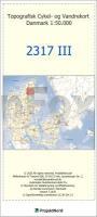
2317-III Aalborg - mit Wanderwegen und Fahrradrouten Topographische Fahrradkarte und Wanderkarte Dänemark 1:50.000 - Kort & Matrikelstyrelsen ProjektNord
2317-III Aalborg - Topografisk Cykel- og Vandrekort Danmark
Preis: EUR 24.90
|
| 


