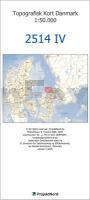
| << Dänemark: Topographische Landkarten und Topographische Wanderkarten / Fahrradkarten 1:50.000 |
  | |
|
||
Zuletzt angesehene Artikel:
![]() | 2514-IV Topographische Karte Dänemark 1:50.000 - Kort & Matrikelstyrelsen ProjektNord |
![]() | 6430 Emskirchen Topographische Landkarte Bayern 1:25.000 - Normalausgabe - ProjektNord (geplottete Ausgabe) - Grundlage amtliche Topographische Karte Bayern DTK25 |
![]() | N5314 Kumpuranta Topographische Karte 1:25.000 EUREF (Peruskartta) Maanmittauslaitos / Lantmäteriverket Finnland - ProjektNord |
![]() | Provinz Hainan (China) Guide map mit Begleitbroschüre (chinesisch) Dipper - China |
![]() | 4041 Straach Sonderausgabe mit Wanderwegen - Topographische Wanderkarte Brandenburg 1:25.000 ProjektNord |
![]() | NJ 35-8 Usak Amtliche Topographische Karte der Türkei 1:250.000 NJ 35-8 Uşak - Müşterek Harekat Haritası HGK |
![]() | 4446 Bad Liebenwerda Sonderausgabe mit Wanderwegen - Topographische Wanderkarte Brandenburg 1:25.000 ProjektNord |
![]() | Iwanowo Stadtplan - Oblast Iwanowo Straßenkarte 1:22.000 / 1:500.000 Иваново, Ивановская область Rus Co. Ltd. |
![]() | 05O HARLINGEN (Oost) Topographische Karte der Niederlande 1:50.000 Topografische Dienst (Plotausgabe) |
![]() | Prince Edward Island 1:250.000 Touristische Landkarte Road map GM Johnson |
![]() | 12-33 Plzen (Originalausgabe) Amtliche Topographische Karte 1:50.000 der Tschechischen Republik Zakladnà mapa Ceská republika - Cesky urad zememericky a katastralni |
![]() | 6002 Gemünd - Wanderkarte mit Wanderwegen (geplottete Ausgabe) ProjektNord - Grundlage Amtliche topographische Karte Landesamt für Vermessung und Geobasisinformation Rheinland-Pfalz |
![]() | N6212 Öllölä. Topographische Karte 1:25.000 EUREF (Peruskartta) Maanmittauslaitos / Lantmäteriverket Finnland - ProjektNord |
![]() | 7531 Gersthofen Topographische Landkarte Bayern 1:25.000 - Normalausgabe - ProjektNord (geplottete Ausgabe) - Grundlage amtliche Topographische Karte Bayern DTK25 |
![]() | 5630 Bad Rodach Topographische Landkarte Bayern 1:25.000 - Normalausgabe - ProjektNord (geplottete Ausgabe) - Grundlage amtliche Topographische Karte Bayern DTK25 |
![]() | Alborz, Central (Blatt 386) 1:200.000 Landkarte Englisch und Persisch General Map of Central Alborz نقشه البرز مركزي Gitashenasi - Iran |
![]() | N4311 Jämsä Topographische Karte 1:25.000 EUREF (Peruskartta) Maanmittauslaitos / Lantmäteriverket Finnland - ProjektNord |
![]() | U5242 Topographische Karte 1:25.000 EUREF (Peruskartta) Maanmittauslaitos / Lantmäteriverket Finnland - ProjektNord |
![]() | Portugal 1:335.000 Regionalkarte / Straßenkarte Portugal IGN - Frankreich |


