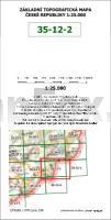
 Amtliche topographische Karte der Tschechischen Republik. Die Fläche jeder Karte beträgt in der Ursprungsversion ca. 40x40 cm - Diese neue Karte von ProjektNord ist wesentlich größer und überschneidet mit 66 x 49 cm weite Teile der Nachbarblätter.  Kartenbeispiel 1:200.000 Kartenbeispiel 1:200.000
Kartenbeispiel 1:100.000
Kartenbeispiel 1:50.000
Kartenbeispiel 1:25.000
Kartenbeispiel 1:10.000 Blattschnitte gesamt So ermitteln Sie die Kartennummer: 1:200.000: Die große Zahl ist die Kartennummer (z.B. 24) 1:100.000: Jede 1:200.000er Karte unterteilt sich in 4 Blätter 1:100.000. 1=Nordwest, 2=Nordost, 3=Südwest, 4=Südost (Beispiel: 24-3) 1:50.000: Jede 1:100.000er Karte unterteilt sich in 4 Blätter 1:50.000. 1=Nordwest, 2=Nordost, 3=Südwest, 4=Südost (Beispiel: 24-32) 1:25.000: Jede 1:50.000er Karte unterteilt sich in 4 Blätter 1:25.000. 1=Nordwest, 2=Nordost, 3=Südwest, 4=Südost (Beispiel: 24-321) 1:10.000: Jede 1:50.000er Karte unterteilt sich in 25 Blätter 1:10.000. Durchnumeriert von 01 (im Nordwesten) bis 25 (im Südosten) (Beispiel: 24-21-08) (In den Blattschnitten finden Sie die genannten Beispiele wieder.) Außerhalb der Staatsgrenze liegende Gebiete bleiben in der Regel weiß oder enthalten eine Ersatzkartographie. Kartenausschnitt
|
35-122 Topographische Karte 1:25.000 der Tschechischen Republik
Zakladní mapa Ceská republika Cesky urad zememericky a katastralni - ProjektNord
Preis: EUR 24.90
|
| 


