| << Ukraine |
  | |
|
||
Zuletzt angesehene Artikel:
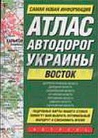
![]() | Ukraine - der Osten - Straßenatlas 1:540.000 Autoatlas / Straßenatlas - Ukraine Атлас автодорог Украины. Восток Russland |
![]() | TJ10 Bay of Fires 1:50.000 Topographische Landkarte Tasmanien - Australien - Tasmap (Tasmanien) |
![]() | Ruppiner Schweiz Topographische Wanderkarte mit Wanderwegen und Radwegen 1:50.000 - ProjektNord |
![]() | 138 Stiavnicke Vrchy Wanderkarte Slowakei 1:50.000 - VKU |
![]() | Neisse - Freiwaldau 1:75.000 Wanderkarte, Fahrradkarte, Wintersportkarte Plan - Galileos - Polen Nysa - Jesenik PLAN Galileos - Polen |
![]() | M-33-45-A/B Swidnica Amtliche topographische Landkarte Polen 1:50.000 M-33-45-A/B Swidnica - Mapa Topograficzna Polski Glowny Geodeta Kraju |
![]() | M-34-5-A/B Skierniewice Amtliche topographische Landkarte Polen 1:50.000 M-34-5-A/B Skierniewice - Mapa Topograficzna Polski Glowny Geodeta Kraju |
![]() | Håsteinen - Batalden - Seekarte Norwegische Küste 1:50.000 - (Blatt 27) Den Norske Kyst Sjøkart - Hovedkart (sjø) Statens Kartverk Sjø - Norwegen |
![]() | Sowata Ortsplan 1:12.000 Sovata / Szováta GeoCart Rumänien |
![]() | Herrnhut - Ostritz (Blatt 50) Topographische Wanderkarte Sachsen 1:30.000 mit Wanderwegen - ProjektNord |
![]() | M-34-25-C/D Praszka Amtliche topographische Landkarte Polen 1:50.000 M-34-25-C/D Praszka - Mapa Topograficzna Polski Glowny Geodeta Kraju |
![]() | Hochschwab - Zwischen Salzatal und Murtal 52 Touren - Rother Wanderführer - Bergverlag Rother |
![]() | El Pont de Suert (Blatt 22) 1:25.000 Besiberri Nord, Vall de BoÃ, Vall de Barravés - Wanderkarte Katalonien (Spanien) - Col·lecció Capitals Comarcals - Institut Cartogrà fic de Catalunya |
![]() | 445 Neuhaus - Böhmisch Kanada Wanderkarte Tschechien 1:40.000 - SHOCart Jindrichohradecko - Ceska Kanada - SHOCart |
![]() | Monte Grappa - Dolomiti Bellunesi - Lagorai Wanderführer (italienisch) - LIBRERIA ZANETTI - Italien |
![]() | 228 HOHER FRESCHEN 1:50.000 Topographische Landeskarte der Schweiz - swisstopo |
![]() | 49/1-2 Esneux NGI 1:25.000 Topographische Landkarte Belgien |
![]() | Skiathos (Blatt 347) Landkarte Griechische Inseln 1:25.000 Σκιάθος Orama - Griechenland |
![]() | M-34-71-A/B Cieszanow Amtliche topographische Landkarte Polen 1:50.000 M-34-71-A/B Cieszanow - Mapa Topograficzna Polski Glowny Geodeta Kraju |


