Willkommen bei MapFox
Wurde Ihre Bestellung bestätigt? Wenn nicht - gab es evtl. ein SERVER-Problem! Bitte kontaktieren Sie uns! +++ Buchhändler-Anfragen erwünscht +++
Warenkorb
Artikel: 0 - € 0.00
Zur Kasse
Impressum Kontakt Versandkosten AGB
Mustang by Road - Offroad Guide 4x4 Guide - Himalayan MapHouse - Nepal
<< Nepal
<< Himalayan Map House
 
Cover

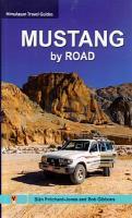
Mustang is a magical and mystical Shangri-La. Hidden for centuries behind the Himalya, this high and wild land has remained almost untarnished. As Mustang stirs into modernity, with easier access by new roads, the spirit of old Tibet lingers on in its cultural treasures: walles cities, crumbling fortresses, inaccessible cave dwellings, ancient monasteries and secretive religious art. The wildest dreams of nature unfold: a panorama of strangely eroded fairytale outcrops, pinnacles and twisted turrets. Mysterious canyons and fantastically etched, contorted cliffs and painted in a myriad of vivid colours.

The first edition of this groundbreaking travel guide, packed with cultural detail, is an indispendable companion for those exploring this lost paradise by road. Whether by 4x4 or on two wheels... on four legs (horseback) or your own two feet... this is the definitive guide!

Kartenbeispiel

Mustang by Road - Offroad Guide 4x4 Guide - Himalayan MapHouse - Nepal
EAN / ISBN: 9789937993531
Preis: EUR 21.90

sofort versandfertig Dieser Artikel ist im Normalfall sofort lieferbar.
Produkt EUR Anzahl Bestellen
Mustang by Road - Offroad Guide 4x4 Guide - Himalayan MapHouse - Nepal 21.90
Versandkostenfrei in Deutschland ab 30,- Bestellwert

incl. MwSt.

Stichworte, die bei der Suche nützlich sein könnten:
Offroad Guide - 4x4 Guide - Mustang Reiseführer - Mustang travel guide - Mustang - Nepal - Nepal Landkarten - Nepal Reiseführer - Nepal Atlanten - Nepal Kartographie - Nepal Fahrradkarten - Nepal Radwanderkarten - Nepal Karten - Nepalkarten - Nepal Kartografie - Nepal Wanderkarten - Nepal Landkartenverkauf - Nepal Radwanderführer - Nepal Straßenkarten - Himalayan Map House - Nepal - Himalaya Trekkingkarten - Nepal Landkarten

Zuletzt angesehene Artikel:

CoverMustang by Road - Offroad Guide 4x4 Guide - Himalayan MapHouse - Nepal

CoverBritain & Ireland road atlas Collins

CoverWalking the Cammino Materano Three long-distance routes through Italy´s Puglia and Basilicata regions to Matera - von Price, Gillian - Cicerone Press Limited

Noch kein Cover vorhandenSonderauftrag Planokarte 3 x 3 m - 16-teilig à 75 x 75 cm

CoverTrekking Patagonia´s Torres del Paine - Trekking Guide - The O, the W, the Q and day-hikes - Knife Edge Outdoor Guidebooks

CoverTrekking around West Nepal Trekking Guide - Himalayan MapHouse - Nepal

CoverTrekking in the Indian Himalaya Trekkingführer - by Brian Furze - Cicerone

Cover115P11 McQuesten Topographische Landkarte 1:50.000 - Canada - Yukon

Noch kein Cover vorhandenWalking on Rum and the Small Isles Rum, Eigg, Muck, Canna - von Edwards, Peter, Featherstone, Katie - Cicerone Press Limited

CoverValpelline (Blatt 203) 1:25.000 - Wanderkarte - Oyace - Bionaz - Lago di Place Moulin - Lignan - Vallon de Saint-Barthélemy - Topographische Wanderkarte - Italien/Frankreich - HIKING MAPS Geo4map 1:25.000 Geo4 Map - Italien

CoverIl Cammino Francescano della Marca - 170 km a piedi da Assisi ad Ascoli Piceno - Radwanderführer (italienisch) - TERRE DI MEZZO

CoverAzoren (Nr. 5917) Wanderführer. 90 Touren - KOMPASS

CoverTrekking Around Makalu - Yeti Foot Trail Trekking Guide - Himalayan MapHouse - Nepal

Cover15 Short Walks in the Forest of Dean - von Dunn, Mike - Cicerone Press Limited

CoverFettnäpfchenführer Japan Der unterhaltsame Reiseknigge - das Original - von Fels, Kerstin Fels, Andreas - Bruckmann

Cover115P McQuesten - Yukon Territory Topographische Landkarte 1:250.000 - Canada - Yukon

Noch kein Cover vorhandenL3748 Storkow UNGEFALTET Topographische Karte 1:50.000 (Regelblattschnitt) Landesvermessungsamt Brandenburg

Cover105M13 Mount Haldane - Yukon Territory Topographische Landkarte 1:50.000 - Canada - Yukon

Noch kein Cover vorhandenZlatibor 1:7.500 Wanderkarte
Zlatibor térkép Intersistem Kartografija

CoverBikepacking King Alfred´s Way 350 km gravel route from Winchester - von Hunton, Edward - Cicerone Press Limited