| << Russland |
||
|
||
Zuletzt angesehene Artikel:
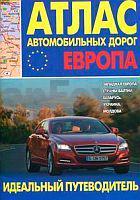
 | Europa - Westeuropa - Baltische Staaten - Weißrussland - Ukraine - Moldau Autoatlas / Straßenatlas - Russland Atlas awtomobilnych dorog. Ewropa. Sapadnaja Ewropa, strany Baltii, Belarus, Ukraina, Moldowa |
 | Ostwall - Lagower Seengebiet / Lagow - Königswalde Touristische Wanderkarte 1:60.000 mit Stadtplänen (Lagow - Königswalde - Zielenzig - Schwiebus - Meseritz) MIĘDZYRZECKI REJON UMOCNIONY - POJEZIERZE ŁAGOWSKIE / Łagów - Lubniewice (- Sulecin - Świebodzin - Międzyrzecz) PLAN Galileos - Polen |
 | Karaj & Fardis (Blatt 1517) Stadtplan 1:19.000 (persisch/englisch) Naqshah-i rāhnamā-yi manāṭiq-i shahrdārī-i Karaj va Fardīs Gitashenasi - Iran |
 | Ostfriesland Radregion 1:75.000 Zwischen Oldenburg, Ems und Nordsee - bikeline Radwanderführer - Esterbauer |
 | Oberitalienische Seen Laminierte Touristische Straßenkarte 1:285.000 Italien Les Lacs Italiens Michelin |
 | Essen Topographische Wanderkarte Nordrhein-Westfalen mit Wanderwegen und Radwegen 1:25.000 - ProjektNord |
 | L7516 Freudenstadt Topographische Landkarte 1:50.000 - Landesvermessungsamt Baden-Württemberg |
 | Glockner-Region: Heiligenblut - Mölltal - Kreuzeckgruppe 50 Touren - Rother Wanderführer von Walter Mair - Bergverlag Rother |
 | Vietnam - Laos - Kambodscha 1:2 Mio. VIETNAM - LAOS - KAMPUCHEA - Internationale Landkarte - Cartographia |
 | NR15 Auvergne-Rhône-Alpes (Massif Alpin) Regionalkarte / Straßenkarte Frankreich 1:250.000 - IGN |
 | 25 Bristol, Bath & Mendips Wanderkarte 1:25.000 Großbritannien AA Automobile Association / OS Ordnance Survey Großbritannien |
 | Aquitaine Regionale Straßenkarte 1:200.000 (Blatt 524) Michelin Frankreich Frankreich |
 | 55 Karlstad 1:50.000 (wasserfest) Topographische Wanderkarte - Sverigeserien Topo50 - Schweden Kartförlaget |
 | Zentralfrankreich Regionale Straßenkarte 1:200.000 (Blatt 518) Michelin Frankreich |
 | 31 Chatham Islands Topographische Landkarte Neuseeland 1:250.000 Land Information New Zealand |
 | 302 Northallerton & Thirsk - Catterick & Bedale - Wanderkarte Großbritannien 1:25.000 EXPLORER MAP - Ordnance Survey |
 | BC34 Topographische Landkarte Neuseeland 1:50.000 Land Information New Zealand |
 | Serbien und Montenegro - Bosnien-Herzegowina - Mazedonien Straßenkarte 1:800.000 - Cartographia Serbia, Montenegro, Bosna-Herzegovina, Macedonia |
| Salmon Arm - TOPO (Blatt TOBC24) Topographische Landkarte - Backroad Topo Map Kanada |
 | Mongolei 1:2 Mio. - geografische Karte MONGOLIA - geographical map GiziMap |