| << Russland |
||
|
||
Zuletzt angesehene Artikel:
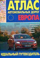
 | Europa - Westeuropa - Baltische Staaten - WeiÃrussland - Ukraine - Moldau Autoatlas / StraÃenatlas - Russland Atlas awtomobilnych dorog. Ewropa. Sapadnaja Ewropa, strany Baltii, Belarus, Ukraina, Moldowa |
 | NL 33-02-14 Ost (4214-Ost) Johnsbach Ãsterreichische Karte 1:25.000 mit Wegmarkierungen (topographische Wanderkarte - UTM) - BEV - Ãsterreich - VergröÃerung (ÃK25V) |
 | 0985-1 LA CELADA Topographische Landkarte 1:25.000 Spanien (Grundlage MTN25) Instituto Geográfico Nacional - CNIG Spanien - ProjektNord |
 | 2811 09 Lavivaara Topographische Karte 1:20.000 (Maastokartta / Peruskartta / Grundkarta) Maanmittauslaitos / Lantmäteriverket Finnland - ProjektNord |
| Zirchow Kr. Usedom-Wollin Topographische Karte 1:25.000 Messtischblatt des Deutschen Reiches - PreuÃische Landesaufnahme / Reichsamt für Landesaufnahme - Faksimile ProjektNord |
 | 0579-2 SOTILLO DE LA ADRADA Topographische Landkarte 1:25.000 Spanien (Grundlage MTN25) Instituto Geográfico Nacional - CNIG Spanien - ProjektNord |
 | 0457-1 MOZONCILLO Topographische Landkarte 1:25.000 Spanien (Grundlage MTN25) Instituto Geográfico Nacional - CNIG Spanien - ProjektNord |
 | 3842 12 Kiviselkä Topographische Karte 1:20.000 (Maastokartta / Peruskartta / Grundkarta) Maanmittauslaitos / Lantmäteriverket Finnland - ProjektNord |
 | 4231 04 VALKIAVAARA Topographische Karte 1:20.000 (Maastokartta / Peruskartta / Grundkarta) Maanmittauslaitos / Lantmäteriverket Finnland - ProjektNord |
 | NL 33-01-09 West (3209-West) Unken Ãsterreichische Karte 1:25.000 mit Wegmarkierungen (topographische Wanderkarte - UTM) - BEV - Ãsterreich - VergröÃerung (ÃK25V) |
 | 3831 07 KIILOPÃà Topographische Karte 1:20.000 (Maastokartta / Peruskartta / Grundkarta) Maanmittauslaitos / Lantmäteriverket Finnland - ProjektNord |
 | 0904-3 ANDÃJAR Topographische Landkarte 1:25.000 Spanien (Grundlage MTN25) Instituto Geográfico Nacional - CNIG Spanien - ProjektNord |
 | 0151-2 A POBRA DO CARAMIÃAL Topographische Landkarte 1:25.000 Spanien (Grundlage MTN25) Instituto Geográfico Nacional - CNIG Spanien - ProjektNord |
 | 0828-2 SANTA MARTA Topographische Landkarte 1:25.000 Spanien (Grundlage MTN25) Instituto Geográfico Nacional - CNIG Spanien - ProjektNord |
| 2092 Kabienen Topographische Karte 1:25.000 Messtischblatt des Deutschen Reiches - PreuÃische Landesaufnahme / Reichsamt für Landesaufnahme - Faksimile ProjektNord |
 | Ueckermünde, Torgelow, Eggesin und Umgebung - Radwander- und Wanderkarte 1:50.000 (Nr. 218) Ausflüge am Stettiner Haff zwischen Ducherow, Mönkebude, Nowe Warpno, Luckow und Jatznick. Radwander- und Wanderkarte, Radtourenvorschläge mit Entfernungsangaben. Viele Tipps zu Sehenswürdigkeiten. GPS-fähig. Dr. Barthel Verlag |
 | 0554-1 LA HORCAJADA Topographische Landkarte 1:25.000 Spanien (Grundlage MTN25) Instituto Geográfico Nacional - CNIG Spanien - ProjektNord |
| Irkutsk - Südliches Baikalsee-Umland - Taschenatlas 1:200.000 / 1:25.000 Russland Irkutsk / Juzhnoe Pribajkale Atlas karmannyj Irkutskaya Kartografitscheskaya Fabrika (Russland) - VostSib AGP |
 | Ostseeküste Polen Touristische Landkarte 1:200.000 Laminierte Landkarte Pobrzeże Bałtyku laminowana mapa turystyczna Demart - Polen |
 | 0780-2 PUEBLA DE ALCOCER Topographische Landkarte 1:25.000 Spanien (Grundlage MTN25) Instituto Geográfico Nacional - CNIG Spanien - ProjektNord |