| << Rumänien: Wanderkarten von Zenith |
||
|
||
Zuletzt angesehene Artikel:
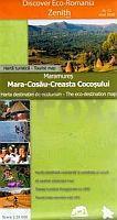
 | Maramureș 1:35.000 (Blatt 12) Touristische Wanderkarte - Bergwanderkarte Mara - Cosău - Creasta Cocoșului - Harta turistica / Tourist map Zenith - Rumänien |
 | 43-d Topographische Landkarte Georgien 1:50.000 Geoland Maps Georgien |
 | Norwegen: Jotunheimen - Rondane - Dovrefjell 52 Touren. Mit GPS-Daten - von Bernhard Pollmann - Bergverlag Rother |
 | Liste der Leuchtfeuer an Finnlands Küsten Finnish List of Lights - Fyrar vid Finlands Kuster - Suomen rannikon loistot Karttakeskus - Genimap Finnland |
| 43-c Topographische Landkarte Georgien 1:50.000 Geoland Maps Georgien |
| CG15 Topographische Landkarte Neuseeland 1:50.000 Land Information New Zealand |
 | 4 Slowakisches Paradies Wanderkarte Slowakei 1:25.000 4 Slovensky Raj - VKU Slowakei |
 | Argentinien: Bariloche - Siete Lagos 1:1 Mio. Touristische Landkarte /Straßenkarte Argentina: Bariloche/Siete Lagos - Regional Map DeDios Editores - Argentinien |
| BW16 Topographische Landkarte Neuseeland 1:50.000 Land Information New Zealand |
 | Frisches Haff - Radwege und Wanderwege Touristische Topographische Landkarte und Wanderkarte Polen 1:75.000 / 1:250.000 (Blatt 242) Kraina Zalewu Wislanego - Zulawy Wislane - Mierzeja Wislana - Wysoczyna Elblaska - Pobrzeze Staropruskie Eko-Kapio - Cartomedia |
 | N-33-77/78 Swinoujscie (Swinemünde) Plot aus der Kartengrundlage der amtliche topographische Karte Polen 1:100.000 ProjektNord |
 | 4 Westhoek fietsnetwerk Fahrradkarte (wasserfest) 1:50.000 - Belgien Fietsnetwerk Belgien |
 | Wintersportkarte Riesengebirge 1:60.000 Krkonose Riesengebirge - Zimni turisticka a lyzarská mapa SHOCart - Tschechien |
| 8211 Kandern Topographische Landkarte 1:25.000 - Landesvermessungsamt Baden-Württemberg |
 | Carrascal de la Font Roja Wanderkarte 1:25.000 El Tossal Cartographies - Valencia - Spanien |
 | Cevennen - Ardèche - mit Grands Causses - Aigoual-Massiv und Mont Lozere - 56 Touren Rother Wanderführer - Bergverlag Rother |
| BB32 Topographische Landkarte Neuseeland 1:50.000 Land Information New Zealand |
 | Colombia Country Guide Reiseführer (engl.) Lonely Planet |
 | Nikosia (Blatt 11) Provinz-Straßenkarte Zypern 1:100.000 Orama - Griechenland ΛΕΥΚΩΣΙΑ ΕΠΑΡΧΙΑ & ΠΟΛΗ |
| 009 S Åseral SØR 1:50.000 - Amtliche Topographische Landkarte Norwegen - Startens Kartverk |