| << Finnland << Genimap / Karttakeskus Finnland |
||
|
||

Zuletzt angesehene Artikel:
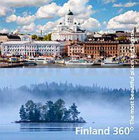
 | Finland 360° The most beautiful places and sights - Bildband Karttakeskus - Genimap Finnland |
 | 4552 Weißkollm Amtliche Topographische Landkarte 1:25.000 (Präsentationsgrafik) - Landesvermessungsamt Sachsen |
 | 116 Amorgos 1:35.000 Touristische Wanderkarte/Landkarte Griechische Inseln - Road Editions - Griechenland |
 | Ruppiner und Kyritzer Seenkette *** SCHNÄPPCHEN *** Topographische Wanderkarte mit Wanderwegen und Radwegen 1:50.000 - ProjektNord |
 | L3736 Burg Topographische Karte 1:50.000 Landesamt für Vermessung und Geoinformation Sachsen-Anhalt (Landesvermessungsamt) |
 | 2947 Templin - Vietmannsdorf Topographische Karte 1:25.000 Landesvermessungsamt Brandenburg (gefaltet) |
 | Ossola Alpinwandern Zwischen Lago Maggiore, Nufenenpass und Monte Rosa - von Kundert, Remo Volken, Marco - SAC-Verlag Schweizer Alpen-Club |
 | Western Canada Landkarte 1:2 Mio. British Columbia, Alberta, Saskatchewan, Manitoba cccmaps Canadian Cartographics Corporation MapArt Publishing Kanada |
 | L3114 Cloppenburg Amtliche topographische Karte 1:50.000 Landesvermessungsamt Niedersachsen |
 | 10070 Hjørundfjorden Topographische Landkarte 1:50.000 Norge-serien - Nordeca Norwegen |
 | 4324 Hardegsen Topographische Wanderkarte 1:25.000 Niedersachsen mit Wanderwegen - ProjektNord |
 | Britisch-Kolumbien Süd 1:750.000 Landkarte - ITMB International Travel Reference Map (engl.) British-Columbia South - Calgary to Vancouver ITMB International Travel Maps (engl.) |
 | 30 MARCO POLO Freizeitkarte Saarland - Obermosel Trier 1:115.000 wasserfest, reißfest |
 | 3079 Thüringer Wald, Südlicher - Suhl - Coburg Fahrradkarte. GPS-genau. 1:70.000 (wasserfest) KOMPASS-Karten |
 | L5328 Kurort Schmalkalden Topographische Karte Thüringen 1:50.000 Landesvermessungsamt Thüringen |
 | 3 Südjütland - Radwanderkarte 1:100.000 wasserfest 3 Sydjylland - Cykelkort / Cycle Map Cyklistforbundet Dänemark - Legind |
 | L3532 Mieste Topographische Karte 1:50.000 Landesamt für Vermessung und Geoinformation Sachsen-Anhalt (Landesvermessungsamt) |
 | 1194 FLIMS 1:25.000 - Panixerpass - Vorab - Laax - Topographische Landeskarte der Schweiz - swisstopo |
 | Lykien Ost - topographische Wanderkarte 1:50.000 (dt./türk./engl./franz.) von Martin Höpke Lycia East Hiking Map MapSite Verlag |
 | Pella (Blatt 180) Präfektur Landkarte 1:200.000 Πέλλα Orama - Griechenland |