Willkommen bei MapFox
Wurde Ihre Bestellung bestätigt? Wenn nicht - gab es evtl. ein SERVER-Problem! Bitte kontaktieren Sie uns! +++ Buchhändler-Anfragen erwünscht +++
Warenkorb
Artikel: 0 - € 0.00
Zur Kasse
Impressum Kontakt Versandkosten AGB
Southern Morocco by Pitt, Martin - Crossbill Guides Foundation
<< Crossbill Guides - Euronatur Service
 
Cover

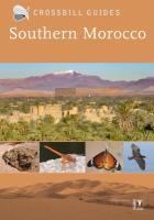
Southern Morocco has a stunning and diverse landscape ranging from the snow-capped peaks of the High Atlas down to sand dunes of the Sahara. This area has an unparalleled ecological diversity and is home to many unique species, ranging from the iconic Bald Ibis to the many endemics in all branches of flora and fauna. It is not surprising that this region is high on the must-visit list of naturalists, birdwatchers and everyone who loves nature and exotic scenery. The Crossbill Guide Southern Morocco is the authoritative wildlife and nature travel guidebook to the country south of Marrakech, including the High and Anti-Atlas Mountains, arid steppes and the Moroccan part of the Sahara Desert. The book provides insights into how this varied landscape came into being with a description of its flora and fauna. The book combines this background with carefully selected hiking and driving routes that cover the best places to discover Southern Morocco´s wildlife and ecosystems. If you want to explore Southern Morocco´s unique wild side, this is the book you need. * 25 routes (car and walk) * 29 site descriptions * Where to watch birds information * Finding butterflies, wildflowers, reptiles, etc. * Detailed background information on landscape and ecology

Southern Morocco by Pitt, Martin - Crossbill Guides Foundation
EAN / ISBN: 9789491648212
Preis: EUR 28.95

Bestellartikel: versandfertig in ca. 1-3 Wochen. Dieser Artikel wird speziell für Sie bestellt. Keine Rücknahme!
Produkt EUR Anzahl Bestellen
Southern Morocco by Pitt, Martin - Crossbill Guides Foundation 28.95
Versandkostenfrei in Deutschland ab 30,- Bestellwert

incl. MwSt.

Stichworte, die bei der Suche nützlich sein könnten:
Marokko Reiseführer (englisch)

Zuletzt angesehene Artikel:

CoverSouthern Morocco by Pitt, Martin - Crossbill Guides Foundation

Cover5809 Treis-Karden Topographische Karte 1:25.000 - Landesamt für Vermessung und Geobasisinformation Rheinland-Pfalz

CoverFahrradkarte Radweg Berlin-Dresden Inklusive aller fahrradfreundlichen Unterkünfte an der Strecke - ADFC Sachsen e.V.

CoverItalien 1606 Historische Landkarte auf Pergament (Faksimile) - 50 x 37,5 cm - PLANO gerollt Antica

CoverSchwarzwald - Wandern & Einkehren Zwischen Pforzheim und Freiburg - 50 Touren - GPS - von Sabine Malecha, Joachim Lutz - Bergverlag Rother

Cover0/12 Hunza - Karakorum 1:100.000 - Trekkingkarte Alpenvereinskarte - DAV Deutscher Alpenverein

CoverLand des Hermann - Lippischer Südosten - Wanderkarte NRW 1:25.000 Barntrup - Blomberg - Lügde - Schieder-Schwalenberg. Mit den Wanderweg `Pilger in Lippe`. Hrsg.: Lippischer Heimatbund / Teutoburger-Wald-Verein - Bonifatius

CoverMallorca West 1:60.000 (RK-MALLO01) - Tramuntana - Palma - Andratx - Sóller - Alcúdia - Inca bikeline-Radkarte - Spanien Esterbauer

CoverHawaii - Big Island - Maui - Molokai - Lanai - Oahu - Kauai 1:100.000-1:220.000 Auto- + Freizeitkarte
Hawaï freytag & berndt

CoverBaumberge Topographische Wanderkarte Nordrhein-Westfalen mit Wanderwegen und Radwegen 1:25.000 - ProjektNord

Noch kein Cover vorhanden32-23-19 Topographische Karte 1:10.000 der Tschechischen Republik
Zakladní mapa Ceská republika - Cesky urad zememericky a katastralni - ProjektNord

CoverFrische Nehrung - Polen Topographische Wanderkarte und Touristische Landkarte 1:15.000
Mierzeja Wiślana ProjektNord

Noch kein Cover vorhanden12-11-08 Topographische Karte 1:10.000 der Tschechischen Republik
Zakladní mapa Ceská republika - Cesky urad zememericky a katastralni - ProjektNord

Cover2121 07 Vammala Topographische Karte 1:20.000 (Maastokartta / Peruskartta / Grundkarta) Maanmittauslaitos / Lantmäteriverket Finnland - ProjektNord

Cover4231 09 Hatunvaara Topographische Karte 1:20.000 (Maastokartta / Peruskartta / Grundkarta) Maanmittauslaitos / Lantmäteriverket Finnland - ProjektNord

Cover4821 12 Muotkavaara Topographische Karte 1:20.000 (Maastokartta / Peruskartta / Grundkarta) Maanmittauslaitos / Lantmäteriverket Finnland - ProjektNord

Cover1134 02 Sydänmaa Topographische Karte 1:20.000 (Maastokartta / Peruskartta / Grundkarta) Maanmittauslaitos / Lantmäteriverket Finnland - ProjektNord

Cover2211 08 Parkano Topographische Karte 1:20.000 (Maastokartta / Peruskartta / Grundkarta) Maanmittauslaitos / Lantmäteriverket Finnland - ProjektNord