 The Provence is the richest wildlife region of France. Whether you consider the flora and fauna in detail or simply take a broad view of the landscape, every corner of this region is different. There are the spectacular, bird-filled wetlands of the Camargue, but right next to them lies the arid, almost desert-like plateau of La Crau. Then there are the sizzling hot Mediterranean hillsides and the inviting clear seas of the Cote d´Azur. Just a little inland you can marvel at the fairylike, gnarled beech forests on the north slopes and the flower and butterfly rich subalpine plateaus in the mountains. All of this variety is present within the small region of the Provence.
The Crossbill Guide to the Provence and Camargue, France of describes routes and sites found within the region. The book is complemented with extensive chapters on landscape, geology, history, descriptions of the flora and fauna and tips to observe wildlife.
* 25 routes (car and walk)
* 20 site descriptions
* Where to watch birds information
* Finding butterflies, wildflowers, reptiles, etc.
* Detailed background information on landscape and ecology  Kartenausschnitt Kartenausschnitt
Kartenbeispiel
|
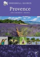
Provence and Camargue - von Hilbers, Dirk Swinkels, Constant Vliegenthart, Albert - Crossbill Guides Foundation
EAN / ISBN: 9789491648168
Preis: EUR 29.95
|
|


