Willkommen bei MapFox
Wurde Ihre Bestellung bestätigt? Wenn nicht - gab es evtl. ein SERVER-Problem! Bitte kontaktieren Sie uns! +++ Buchhändler-Anfragen erwünscht +++
Warenkorb
Artikel: 0 - € 0.00
Zur Kasse
Widerruf Impressum Kontakt Versandkosten AGB
Eastern Andalucia Reiseführer (engl.) Cordoba to Cabo de Gata - Spain - von Vliegenthart, Albert Ten Cate, Bouke - Crossbill Guides Foundation
<< Spanien: Wanderführer, Radwanderführer und Reiseführer
<< Crossbill Guides - Euronatur Service
 
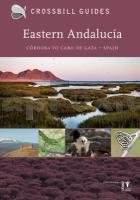
Cover

Andalucía is a land of contrasts. There are wild mountains and extensive marshes, dry semi-desert and barren karst, but also leafy woodlands laced with murmuring streams. The biodiversity is the highest of any of the Spanish regions. Andalucía is the stronghold of the endangered Iberian Lynx. Herds of wild Ibex roam the mountains and large numbers of vultures and eagles nest on remote, precipitous cliffs. Rare, endemic plants grow in the dry riverbeds in the Desierto and numerous butterflies grace the boulder-strewn heights of the Sierra Nevada. Each corner of this, the largest of Spain´s autonomous regions, is different, but all share one characteristic - they all are superb natural areas that stand out for one reason or another.
Andalucía is too large and diverse to do justice in a single guidebook. This book covers eastern Andalucía -Córdoba, Jaen, Granada and Almería. It describes routes and sites in, amongst others, the Sierra Nevada, Sierra de Cazorla, Sierra de Andújar, Cabo de Gata and Desierto de Tabernas.

* 20 routes (car and walk)
* 18 site descriptions
* Where to watch birds information
* Finding butterflies, dragonflies wildflowers, orchids, reptiles, etc.
* Detailed background information on landscape, geology and ecology

Eastern Andalucia Reiseführer (engl.) Cordoba to Cabo de Gata - Spain - von Vliegenthart, Albert Ten Cate, Bouke - Crossbill Guides Foundation
EAN / ISBN: 9789491648106
Preis: EUR 29.95

Bestellartikel: versandfertig in ca. 1-3 Wochen. Dieser Artikel wird speziell für Sie bestellt. Keine Rücknahme!
Produkt EUR Anzahl Bestellen
Eastern Andalucia Reiseführer (engl.) Cordoba to Cabo de Gata - Spain - von Vliegenthart, Albert Ten Cate, Bouke - Crossbill Guides Foundation 29.95
Versandkostenfrei in Deutschland ab 30,- Bestellwert

incl. MwSt.

Stichworte, die bei der Suche nützlich sein könnten:
Andalusien Reiseführer - Spanien Wanderführer - Spanien Radwanderführer - Spanien Fahrradführer - Spanien Reiseführer

Zuletzt angesehene Artikel:

CoverEastern Andalucia Reiseführer (engl.) Cordoba to Cabo de Gata - Spain - von Vliegenthart, Albert Ten Cate, Bouke - Crossbill Guides Foundation

CoverWaldwandern Hessen Auf Försters Pfaden durch die schönsten Wälder. Hrsg.: Hessen-Forst - pmv Peter Meyer Verlag

Cover8 Serrablo - Tierra de Biescas (Pirineo aragonés) - Wanderkarte 1:40.000 Sistema Ibérico - Prames - Spanien

CoverWien - mal anders ungewöhnliche Entdeckertouren Reiseführer Michael Müller Verlag - von Weibrecht, Judith - Michael Müller Verlag

CoverKaschubische Schweiz Touristische Landkarte 1:50.000 Wanderkarte, Radwanderkarte, Freizeitkarte, Kanurouten
Szwajcaria Kaszubska mapa PLAN Galileos - Polen

CoverN° 2 Loire Centre Kanalführer / Waterways Giude / Guide Fluvial - Le canal du Loing, le canal de Briare, le canal latéral à la Loire, le canal du Nivernais, le canal du Centre Wasserstraßen-Führer Frankreich - Édition du Breil

CoverKavadarci Gemeinde-Landkarte 1:140.000 + Touristischer Stadtplan 1:8000
Kavadarci - Karta na grad Trimaks - Mazedonien

CoverNr.15 Nationalpark Cozia 1:30.000 Wanderkarte - Rumänien
Harta turistica / Tpurist map Parcul National Cozia Zenith - Rumänien

CoverGrödnertal, Seiser Alm / Val Gardena, Alpe di Siusi Wander- und Radkarte mit Ausflugszielen & Freizeittipps, wetterfest, reißfest, abwischbar, GPS-genau. 1:35000 - von - Freytag-Berndt und ARTARIA Publicpress

Noch kein Cover vorhanden4859 Löwenberg Topographische Karte 1:25.000 Messtischblatt des Deutschen Reiches - Preußische Landesaufnahme / Reichsamt für Landesaufnahme - Faksimile ProjektNord

Cover1 Bachgau-Maintal 1:20.000 Breuberg, Dieburg, Großostheim, Großwallstadt, Groß-Umstadt, Mömlingen, Niedernberg, Obernburg, Otzberg, Schaafheim - Wander- und Radwanderkarte Odenwald (Hessen) - MeKi Landkarten

CoverMarokko 1:1.5 Mio. - laminierte Landkarte (französisch) comfort!map
Maroc ExpressMap

Noch kein Cover vorhandenN-34-126-A/B Nasielsk Amtliche topographische Landkarte Polen 1:50.000
N-34-126-A/B Nasielsk - Mapa Topograficzna Polski Glowny Geodeta Kraju

CoverBurgen und Schlösser in Thüringen 1:250.000 Landesvermessung und Geobasisinformation Thüringen

CoverK13: Tafraoute nord - Tizourgane - Igherm 1:120.000 + GPS-Waypoints Marokko Touristische Karte - Straße der Agadire / IGOUDAR - www.marokko-erfahren.de - ProjektNord

CoverL5518 Gießen (geplottete Ausgabe) Topographische Landkarte Hessen 1:50.000 - ProjektNord

Cover2830 Dahlenburg Amtliche topographische Karte 1:25.000 Landesvermessungsamt Niedersachsen

CoverBorneo (Indonesien 3) 1:1.2 Mio. Landkarte World mapping project - Reise Know-How Verlag

CoverSauerland mit Rothaarsteig (Nr. 5310) Wanderführer mit Tourenkarte zum Mitnehmen und Höhenprofilen. - von Sylvia Behla, Thilo Behla, Klaus Harnach - KOMPASS-Karten

CoverRoma Una Vera Bellezza - Wanderführer - Carlo Coronati - Edizioni Il Lupo
