| << Schweden: Outdoorkarten 1:50.000 - 1:75.000 von Norstedts << Kungsleden |
  | |
Zuletzt angesehene Artikel:
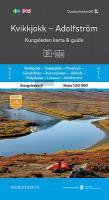
![]() | Kungsleden 4: Kvikkjokk - Adolfström 1:50.000 - Kungsleden Map and Guide Serie - wasserfest Norstedts - Schweden |
![]() | M-34-20-C Amtliche Topographische Karte Ungarn 1:50.000 |
![]() | 1221 LE SENTIER 1:25.000 - Le Grand Risoux - Lac de Joux - Mont Tendre - Topographische Landeskarte der Schweiz - swisstopo |
![]() | G4 Isispynten Spitzbergen / Svalbard / Spitsbergen - Topographische Karte 1:100.000 Norsk Polarinstitutt |
![]() | L-33-22-D-c Amtliche Topographische Karte Ungarn 1:25.000 |
![]() | BC36 Topographische Landkarte Neuseeland 1:50.000 Land Information New Zealand |
![]() | BJ30 Topographische Landkarte Neuseeland 1:50.000 Land Information New Zealand |
![]() | Maio (Kapverdische Inseln) 1:35.000 Topographische Wanderkarte - Mit Wanderwegen und Radwegen Maio (Cabo Verde) ProjektNord |
![]() | L-34-65-A-c Amtliche Topographische Karte Ungarn 1:25.000 |
![]() | BK31 Topographische Landkarte Neuseeland 1:50.000 Land Information New Zealand |
![]() | Grönländisch - Wort für Wort Kauderwelsch-Sprachführer (Band 204) Grönland (Dänemark) - Reise-Know-How Verlag |
![]() | L-33-45-B-c Amtliche Topographische Karte Ungarn 1:25.000 |
![]() | 10001 Farsund Topographische Landkarte 1:50.000 Norge-serien - Nordeca Norwegen |
![]() | BM37 Topographische Landkarte Neuseeland 1:50.000 Land Information New Zealand |
![]() | 06 Val di Fassa e Dolomiti Fassane Topographische Wanderkarte 1:25.000 GPS - Casa Editrice Tabacco - Italien |
![]() | Camino Santiago 15-18 GPS Boadilla - Mansilla Touristische Wanderkarte 1:50.000 - CNIG Spanien |
![]() | Der Wanderführer, Friedewald und Moritzburger Teichlandschaft Heimatkundlicher Wander- und Touristenführer - von Bellmann, Michael - Bellmann, Michael |
![]() | L-34-19-B Balmazujvaros Amtliche Topographische Karte Ungarn 1:50.000 |
![]() | Michigan - Midwest regionale Straßenkarte 1:160.000 (Michigan - USA) Michigan - Midwest regional map GM Johnson |
![]() | 1636SB Libourne - Saint-Emilion GPS Amtliche Topographische Wanderkarte Frankreich 1:25.000 - série bleue (IGN) |


