 Altauflage 2018, daher zum Sonderpreis. Der Grande Traversata delle Alpi ist ein Fernwanderweg über den Westalpenbogen. Der 2. Teil einer 3-teiligen italienischsprachiger Wanderführer-Serie umfasst den Abschnitt von der Wallfahrtskirche von Oropa bis zur Schutzhütte Quintino Sella al Monviso.
Es gibt einen sehr groÃem Anteil an exakten topographischen Kartenausschnitten. 418km zum Wandern 22 Etappen und 5 Varianten Klicken Sie hier, wenn Sie diesen Artikel in der Version zum normalen Preis sehen möchten. Klicken Sie hier, wenn Sie diesen Artikel in der Version zum normalen Preis sehen möchten.
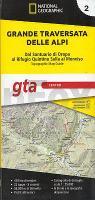
Kartenausschnitt
Kartenbeispiel
|
Grande Traversata delle Alpi (Teil 2) 1:25.000 *** SCHNÃPPCHEN *** Dal Santuario di Oropa al Rifugio Quintino Sella al Monviso - Geo4 Map - Italien
EAN / ISBN: 9788869853708
Preis: EUR 10.00
|
| 
