Willkommen bei MapFox
Wurde Ihre Bestellung bestätigt? Wenn nicht - gab es evtl. ein SERVER-Problem! Bitte kontaktieren Sie uns! +++ Buchhändler-Anfragen erwünscht +++
Warenkorb
Artikel: 0 - € 0.00
Zur Kasse
Widerruf Impressum Kontakt Versandkosten AGB
3MILS.CAT - guide + hiking + MTB 1:50.000 (3M) Wanderkarte mit Wanderführer Spanien / Katalonien (katalanisch) ALPINA
<< Spanien: Wanderkarten - EDITORIAL ALPINA
<< Spanien: Pyrenäen
 
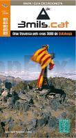
Cover

Wanderkarte zu den Dreitausendern der katalanischen Pyrenäen.

3mils.cat is a walk through a mountain to crown in a row on the road and all the peaks of 3000 meters of Catalonia, designed and documented by Jordi Puigneró i Ferrer.

The crossing has been designed to take in 10 stages of 6 hours on average every day, covering a total of about 125 km and an accumulated rise of about 10.000 meters.

Although it could be within days, this has not been thought through to compete but to enjoy. The route begins at the top of the Hill formally Molières or Mulleres and ends in Pic Rodó de Canalbona, crossing the beautiful valleys as Mollières, Besiberri and Boi, as well as sites of special protection such as the Parc Nacional d’Aigüestrotes-Sant MaMaurici and the Parc Natural de l’Alt Pirineu.

List of summits order of ascension:

? 1.- Tuc de Molières o Mulleres (3.010 m)
? 2.- Pic de Comaloforno (3.029 m)
? 3.- Besiberri Sud (3.024 m)
? 4.- Besiberri Nord (3.008 m)
? 5.- Punta Alta de Comalesbienes (3.014 m)
? 6.- Pic de Sotllo (3.072 m)
? 7.- Pic de Verdaguer (3.129 m)
? 8.- Pica d’Estats (3.143 m)
? 9.- Punta de Gabarró (3.114 m)
? 10.- Pic Rodó de Canalbona (3.004 m)

Blattschnitte ALPINA

Kartenausschnitt

Kartenbeispiel

3MILS.CAT - guide + hiking + MTB 1:50.000 (3M) Wanderkarte mit Wanderführer Spanien / Katalonien (katalanisch) ALPINA
EAN / ISBN: 9788480906050
Preis: EUR 15.80

Bestellartikel: versandfertig in ca. 3-7 Tagen. Dieser Artikel wird speziell für Sie bestellt. Keine Rücknahme!
Produkt EUR Anzahl Bestellen
3MILS.CAT - guide + hiking + MTB 1:50.000 (3M) Wanderkarte mit Wanderführer Spanien / Katalonien (katalanisch) ALPINA 15.80
Versandkostenfrei in Deutschland ab 30,- Bestellwert

incl. MwSt.

Stichworte, die bei der Suche nützlich sein könnten:
3Mils.cat - Pyrenäen Wanderkarte - Pyrenäen - Katalonien Wanderkarte - Alpina-Karten - Wanderkarten Spanien - Spanische Wanderkarten - Editorial Alpina - Alpina Landkarten - Pyrenäen

Zuletzt angesehene Artikel:

Cover3MILS.CAT - guide + hiking + MTB 1:50.000 (3M) Wanderkarte mit Wanderführer Spanien / Katalonien (katalanisch) ALPINA

Cover5022 Schwarzenborn Topographische Landkarte Hessen 1:25.000 - ProjektNord

CoverPérigord Préhistorique plus beaux sentiers à pied Wanderführer - (französisch) Chamina - Frankreich

CoverOrdesa y Monte Perdido Nationalpark E25 1:25.000 (OP) Wanderkarte Spanien - ALPINA

Cover5523 Neuhof Topographische Landkarte Hessen 1:25.000 - ProjektNord

Cover5017 Biedenkopf Topographische Landkarte Hessen 1:25.000 - ProjektNord

Cover5515 Weilburg Topographische Landkarte Hessen 1:25.000 - ProjektNord

CoverWanderkarte Wittgenstein - Bad Berleburg 1:25.000 mit Berlach & Boxberg - grünes herz

CoverWeiter Wandern. 25 Mehrtagestouren in und um Deutschland Inkl. Rother App und GPS-Tracks zum Download - von Heckmann, Kathrin Robst, Romy - Rother Bergverlag

Cover4622 Kassel West Topographische Landkarte Hessen 1:25.000 - ProjektNord

Noch kein Cover vorhanden069 S Trysil SØR 1:50.000 - Topographische Landkarte Norwegen - ProjektNord - Startens Kartverk

Noch kein Cover vorhanden162 S Setermoen SØR 1:50.000 - Topographische Landkarte Norwegen - ProjektNord - Startens Kartverk

Noch kein Cover vorhanden157 S Narvik SØR 1:50.000 - Topographische Landkarte Norwegen - ProjektNord - Startens Kartverk

Cover4520 Warburg Topographische Landkarte Hessen 1:25.000 - ProjektNord

CoverSchweden (Blatt 3332) - 1:975.000 Landkarte Adventure Map
Sweden National Geographic

CoverAlpes-Maritimes - 30 plus beaux sentiers à pied Wanderführer - (französisch) Chamina - Frankreich

Cover5723 Altengronau Topographische Landkarte Hessen 1:25.000 - ProjektNord

CoverWanderkarte Seeberg - Krahnberg mit Berlach & Boxberg - von mr-kartographie - grünes herz

Noch kein Cover vorhanden094 S Molde SØR 1:50.000 - Topographische Landkarte Norwegen - ProjektNord - Startens Kartverk

CoverUlvik 1:30.000 Høyfjellskart - Gebirgswanderkarte Calazo Förlag Norwegen
