
| << Polen: Wanderkarten: Zentralpolen << EKO-Graf Polen |
||
|
||
Zuletzt angesehene Artikel:
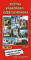
 | Krakau-Tschenstochauer Hochland Touristische Landkarte 1:100.000 Landkarte Wyżyna Krakowsko-Częstochowska mapa EkoGraf - Polen |
 | 409-1 ANIÑÓN Amtliche topographische Landkarte 1:25.000 Spanien (M.T.N.) 409-1 Mapa Topográfico Nacional de Espana (MTN25) Instituto Geográfico Nacional - CNIG Spanien |
 | 554-4 NAVACEPEDA DE TORMES Amtliche topographische Landkarte 1:25.000 Spanien (M.T.N.) 554-4 Mapa Topográfico Nacional de Espana (MTN25) Instituto Geográfico Nacional - CNIG Spanien |
 | Ponikiew Mala Topographische Karte 1:25.000 Messtischblatt des Deutschen Reiches - Preußische Landesaufnahme / Reichsamt für Landesaufnahme - Faksimile ProjektNord |
| Snjadowo Topographische Karte 1:25.000 Messtischblatt des Deutschen Reiches - Preußische Landesaufnahme / Reichsamt für Landesaufnahme - Faksimile ProjektNord |
 | 0723-1 ILLA DEL TORO Y CAP DE CALA FIGUERA Topographische Landkarte 1:25.000 Spanien (Grundlage MTN25) Instituto Geográfico Nacional - CNIG Spanien - ProjektNord |
 | 201-4 VILLAFRANCA MONTES DE OCA Amtliche topographische Landkarte 1:25.000 Spanien (M.T.N.) 201-4 Mapa Topográfico Nacional de Espana (MTN25) Instituto Geográfico Nacional - CNIG Spanien |
 | 241-4 LAGUNA DE CAMEROS Amtliche topographische Landkarte 1:25.000 Spanien (M.T.N.) 241-4 Mapa Topográfico Nacional de Espana (MTN25) Instituto Geográfico Nacional - CNIG Spanien |
 | 1058-3 San Agustín Amtliche topographische Landkarte 1:25.000 Spanien (M.T.N.) 1058-3 Mapa Topográfico Nacional de Espana (MTN25) Instituto Geográfico Nacional - CNIG Spanien |
 | 1061 (11-45) Cádiz Amtliche topographische Landkarte 1:50.000 Spanien (M.T.N.) 1061 Mapa Topográfico Nacional de Espana (MTN50) Instituto Geográfico Nacional - CNIG Spanien |
 | 454 Setúbal Topographische Landkarte Wanderkarte und Fahrradkarte Portugal 1:25.000 454 Mapa topográfico - Mapa de caminhadas - Portugal 1:25.000 ProjektNord |
 | 871-3 Novelda Amtliche topographische Landkarte 1:25.000 Spanien (M.T.N.) 871-3 Mapa Topográfico Nacional de Espana (MTN25) Instituto Geográfico Nacional - CNIG Spanien |
| Lututow Topographische Karte 1:25.000 Messtischblatt des Deutschen Reiches - Preußische Landesaufnahme / Reichsamt für Landesaufnahme - Faksimile ProjektNord |
 | 0328-2 VILANOVA DE MEIÀ Topographische Landkarte 1:25.000 Spanien (Grundlage MTN25) Instituto Geográfico Nacional - CNIG Spanien - ProjektNord |
 | 0362 SANT JOAN DE VILATORRADA Topographische Landkarte 1:50.000 Spanien (Grundlage MTN50) Instituto Geográfico Nacional - CNIG Spanien - ProjektNord |
 | 464-1 ABANTO Amtliche topographische Landkarte 1:25.000 Spanien (M.T.N.) 464-1 Mapa Topográfico Nacional de Espana (MTN25) Instituto Geográfico Nacional - CNIG Spanien |
| 2078 Pelplin Topographische Karte 1:25.000 Messtischblatt des Deutschen Reiches - Preußische Landesaufnahme / Reichsamt für Landesaufnahme - Faksimile ProjektNord |
| NJ 35-11 Aydin Amtliche Topographische Karte der Türkei 1:250.000 NJ 35-11 Aydin - Müşterek Harekat Haritası HGK |
| Sezjan Topographische Karte 1:25.000 Messtischblatt des Deutschen Reiches - Preußische Landesaufnahme / Reichsamt für Landesaufnahme - Faksimile ProjektNord |
 | 789-1 LEZUZA Amtliche topographische Landkarte 1:25.000 Spanien (M.T.N.) 789-1 Mapa Topográfico Nacional de Espana (MTN25) Instituto Geográfico Nacional - CNIG Spanien |