| << Polen: Wanderkarten: Beskiden (Tatra, Vorkarpaten) << CartoMedia Polen |
||
|
||

Zuletzt angesehene Artikel:
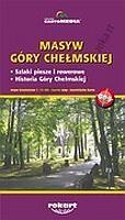
 | Masyw Gory Chelmskiej - Touristische Landkarte 1:15.300 Cartomedia - Rokart - Polen |
 | Wanderparadies Ahrsteig Über 150 Kilometer Wanderspaß durch das Rotweinparadies. Mit Rotweinwanderweg und zwei weiteren Rundtouren. GPS-Daten, Höhenprofile und Karten - volle Information im praktischen Pocket-Format. ideemedia |
 | Baedeker Reiseführer Österreich von Arnold, Rosemarie u. Arnold, Walther R., Bacher, Isolde, Edwards, Nick, Perry, Tim |
 | M4123 Valkeakoski Topographische Karte 1:25.000 EUREF (Peruskartta) Maanmittauslaitos / Lantmäteriverket Finnland - ProjektNord |
 | S4333 Pudasjärvi Topographische Karte 1:25.000 EUREF (Peruskartta) Maanmittauslaitos / Lantmäteriverket Finnland - ProjektNord |
 | Handkarte von Thüringen 1903 - Historische Landkarte Nachdruck Planokarte - gerollt - Verlag Rockstuhl |
 | Rheinhessen - Nahe - Nordpfälzer Bergland 1:50.000 (Blatt 831) - Wanderkarte mit Broschüre KOMPASS |
 | Puisaye-Forterre 1:50.000 Wanderkarte - Reitkarte - Mountainbikekarte - Plein Air - IGN Frankreich Puisaye-Forterre - Randonnées au pays à pied, à cheval, à VTT |
 | Rügen - Stralsund - Hiddensee 1:75.000 (Blatt RK-MV3) bikeline-Radkarte Deutschland Esterbauer |
 | V4432 Topographische Karte 1:25.000 EUREF (Peruskartta) Maanmittauslaitos / Lantmäteriverket Finnland - ProjektNord |
 | FolyMaps Motorradkarten Alpenländer Österreich und Schweiz 1:250.000 - Touristik-Verlag Vellmar |
 | Jenaer Radeltouren Thüringen erleben - von Gerd Kahnis - Grünes Herz |
 | 2933 Gusborn Amtliche topographische Karte 1:25.000 Landesvermessungsamt Niedersachsen |
 | Island Superatlas 1:150.000 - Freytag-Berndt und ARTARIA |
 | L3112 Lumparland Topographische Karte 1:25.000 EUREF (Peruskartta) Maanmittauslaitos / Lantmäteriverket Finnland - ProjektNord |
 | 5 Terre & Portofino - Provincia de La Spezia (Blatt SP-1) Topographische Wanderkarte 1:25.000 Carta dei Sentieri EdM - Edizioni del Magistero - Italien |
 | Münster Ost - Telgte Topographische Wanderkarte Nordrhein-Westfalen mit Wanderwegen und Radwegen 1:25.000 - ProjektNord |
 | 62 Paderborner Land Süd Topographische Wanderkarte 1:25.000 Nordrhein-Westfalen - Eggegebirgsverein |
 | Oblast Odessa 1:250.000 Landkarte, Straßenkarte - Ukraine Odeskaja oblast / Одесскаja область Kartografija - ukrmap Ukraine |
 | Historische WELTKARTE 1782 mit Entdeckungsfahrten von James Cook - Matthäus Lotter - Historische Landkarte - von Matthäus Albrecht Lotter - PLANO gerollt - Verlag Rockstuhl |