Willkommen bei MapFox
Wurde Ihre Bestellung bestätigt? Wenn nicht - gab es evtl. ein SERVER-Problem! Bitte kontaktieren Sie uns! +++ Buchhändler-Anfragen erwünscht +++
Warenkorb
Artikel: 0 - € 0.00
Zur Kasse
Impressum Kontakt Versandkosten AGB
Lofoten - Skiing in the Magic Islands - A ski Tourer`s guide to 40 classic tours in Lofoten - (englisch) Nord Norsk Klatreskole
<< Norwegen: Wanderführer - Radwanderführer - Reiseführer - Kletterführer
 
Cover

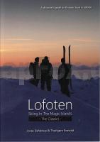
Lofoten - Skiing in the Magic Islands is a guidebook to some of Norway`s most spectacular ski touring terrain. 40 of the most classic ski tours across the islands - from Moskenes and Reine in the west through Trollfjorden in the east.

The book is full of beautiful photos of the region and these will inspire skiers to visit for their first time and seasoned Lofoten visitors to return.

Kartenbeispiel

Lofoten - Skiing in the Magic Islands - A ski Tourer`s guide to 40 classic tours in Lofoten - (englisch) Nord Norsk Klatreskole
EAN / ISBN: 9788271293932
Preis: EUR 49.95

Dieser Titel ist momentan nicht lieferbar.
Produkt EUR Anzahl Bestellen
Lofoten - Skiing in the Magic Islands - A ski Tourer`s guide to 40 classic tours in Lofoten - (englisch) Nord Norsk Klatreskole 49.95
Versandkostenfrei in Deutschland

incl. MwSt.

Stichworte, die bei der Suche nützlich sein könnten:
Lofoten Skitourenführer - Norwegen Reiseführer - Norwegen Wanderführer - Norwegen Radwanderführer - Norwegen Reiseführer - Norwegische Fernradwege - Norwegen Fernradwege - Norwegen Kletterführer

Zuletzt angesehene Artikel:

CoverLofoten - Skiing in the Magic Islands - A ski Tourer`s guide to 40 classic tours in Lofoten - (englisch) Nord Norsk Klatreskole

CoverN4332 Havumäki Topographische Karte 1:25.000 EUREF (Peruskartta) Maanmittauslaitos / Lantmäteriverket Finnland - ProjektNord

CoverP3244 Valsörarna Topographische Karte 1:25.000 EUREF (Peruskartta) Maanmittauslaitos / Lantmäteriverket Finnland - ProjektNord

CoverM5224 Maivala Topographische Karte 1:25.000 EUREF (Peruskartta) Maanmittauslaitos / Lantmäteriverket Finnland - ProjektNord

CoverLandschaftsschutzpark Dreistadt - Freudenthal - Wanderwege Topographische Wanderkarte (Baltt 518)
WĘDRÓWKI PO TRÓJMIEJSKIM PARKU KRAJOBRAZOWYM - Dolina Radości Cartomedia - Sygnatura Polen

CoverBergisches Land - Homburger Ländchen Topographische Wanderkarte Nordrhein-Westfalen mit Wanderwegen und Radwegen 1:25.000 - ProjektNord

CoverDer Harz in 4 Teilen - 1:30:000 Wasserfestes und Reißfestes Wander- und Fahrradkarten-Set: Der Oberharz - Mittlerer Harz - Der Südharz - Der Ostharz - Schmidt-Buch-Verlag

CoverMecklenburgische Seenplatte Mit Schwerin, Ludwigslust, Parchim und Neubrandenburg - von Kerstin Sucher und Bernd Wurlitzer - TRESCHER Verlag

CoverN3421 Teuva Topographische Karte 1:25.000 EUREF (Peruskartta) Maanmittauslaitos / Lantmäteriverket Finnland - ProjektNord

CoverReiseführer Deutschlands Osten - Polens Westen: Niederlausitz - Oberlausitz - Lebuser Land - Niederschlesien 150 x grenzenlos entdeckt - von Christine Stelzer - Steffen Verlag

CoverV5114 Topographische Karte 1:25.000 EUREF (Peruskartta) Maanmittauslaitos / Lantmäteriverket Finnland - ProjektNord

CoverDelbrücker Land Nord Topographische Wanderkarte Nordrhein-Westfalen mit Wanderwegen und Radwegen 1:25.000 - ProjektNord

CoverThasos (Blatt 214) Ökotouristische Landkarte 1:55.000 (wasserfest) GPS
Θάσος Geopsis - Griechenland

CoverMaremma Grossetana Touristische Straßen- und Wanderkarte 1:130.000
Maremma Grossetana L.A.C. GlobalMap Italien

Cover2214-II-SV Topographische Karte Dänemark 1:25.000
Topografisk kort Danmark (DTK/Kort25) 2214-II-SV ProjektNord - Kort & Matrikelstyrelsen / Geodætisk Institut

CoverCC 4734 Leipzig Topographische Übersichtskarte 1:200.000 - Bundesamt für Kartografie und Geodäsie und Landesvermessungsämter - ProjektNord

Cover4507 Mülheim an der Ruhr (geplottete Ausgabe) Amtliche topographische Karte 1:25.000 Landesvermessungsamt Nordrhein-Westfalen

CoverNeustadt (Oberschlesien) Kreiskarte des Deutschen Reiches 1:100.000 (KDR 100 KK) - Faksimile Reichsamt für Landesaufnahme

CoverParque Natural do Sudoeste Alentejano e Costa Vicentina (2) - Mittlerer Teil mit Wanderwegen und Radwegen - Wanderkarte - Fahrradkarte 1:50.000 Portugal - ProjektNord

Cover21 Enschede Topographische Karte der Niederlande 1:100.000 (Plotausgabe) kadaster - Topografische Dienst / ProjektNord