Willkommen bei MapFox
Wurde Ihre Bestellung bestätigt? Wenn nicht - gab es evtl. ein SERVER-Problem! Bitte kontaktieren Sie uns! +++ Buchhändler-Anfragen erwünscht +++
Warenkorb
Artikel: 0 - € 0.00
Zur Kasse
Impressum Kontakt Versandkosten AGB
Phrygian Way (Türkei) Wanderführer 1:100.000 *** SCHNÄPPCHEN *** von Alison Tanık, Hüseyin Sarı - FSK Yayınları - Türkei
<< Türkei: Wanderführer, Kletterführer und Radwanderführer
<< Schnäppchen - Restposten - Mängelexemplare
 
(Titelbild evtl. abweichend)
Cover

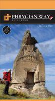
Das Buch ist an der unteren Ecke leicht verknickt, daher zum Sonderpreis.

Englischsprachiger Wanderführer Phrygian Way in der Türkei. Mit einer Wanderkarte 1:100.000.

A 506km walking and bicycle path exploring the Phrygian Valleys.

The first guide book to Turkey’s major new three-branched walking trail - the Phrygian Way, in the area of Gordion, Afyon, Eskişehi and Kütahya.The book describes the countless old roads and footpaths which link the Phrygian monuments and valleys in a network which can be explored on foot ot by bike.

The book is full of photos and has all the info you need to plan your trek, detailed descriptions and times for each section, info about historic places along the route and camping or accommodation facilities.

This edition is the product of 5 years work on this 3000 year old network. The book includes altitude diagrams, detailed and overall mapand is complemented by the website (with GPS points).

Klicken Sie hier, wenn Sie diesen Artikel in der Version zum normalen Preis sehen möchten.

Kartenausschnitt

Phrygian Way (Türkei) Wanderführer 1:100.000 *** SCHNÄPPCHEN *** von Alison Tanık, Hüseyin Sarı - FSK Yayınları - Türkei
EAN / ISBN: 9786058677838
Preis: EUR 20.00

sofort versandfertig Dieser Artikel ist im Normalfall sofort lieferbar.
Produkt EUR Anzahl Bestellen
Phrygian Way (Türkei) Wanderführer 1:100.000 *** SCHNÄPPCHEN *** von Alison Tanık, Hüseyin Sarı - FSK Yayınları - Türkei 20.00
Versandkostenfrei in Deutschland ab 30,- Bestellwert

incl. MwSt.

Stichworte, die bei der Suche nützlich sein könnten:
Hüseyin Sarı - Türkei Wanderführer - Hüseyin Sari - FSK Yayinlari - Alison Tanik - Phrygian Way - Türkei - FSK Yayınları - Alison Tanık - Türkei - Türkei Reiseführer - Türkei Führer - Türkeiführer - Türkeibücher - Türkische Reiseführer - Türkei Wanderführer - Türkei Fahrradführer - Türkei BMX-Führer - Türkei Radwanderführer - Türkei Kletterführer - Schnäppchen - Sonderangebote - Restposten

Zuletzt angesehene Artikel:

CoverPhrygian Way (Türkei) Wanderführer 1:100.000 *** SCHNÄPPCHEN *** von Alison Tanık, Hüseyin Sarı - FSK Yayınları - Türkei

Noch kein Cover vorhanden1626 Kiel - Gestern und Heute - Historische Überlagerung 1932-1950 Topographische Landkarte 1:25.000 im Vergleich - Landesvermessungsamt Schleswig-Holstein / ProjektNord

Cover0311-1 PEDRAZA DE CAMPOS Topographische Landkarte 1:25.000 Spanien (Grundlage MTN25) Instituto Geográfico Nacional - CNIG Spanien - ProjektNord

CoverAu coeur des Massifs de Gavarnie et du Vignemale 1:30.000 - Réf. TC651 Topographische Wanderkarte - FFRP (Fédération française de randonnée pédestre) Frankreich

CoverRostow am Don - Rostower Oblast 1:25.000/1:500.000 Stadtplan / Straßenkarte / Touristenkarte - Russland
Карта автомобильная: Ростов-на-Дону. Ростовская область Rus Co. Ltd.

Cover0734-2 HORCAJO DE LOS MONTES Topographische Landkarte 1:25.000 Spanien (Grundlage MTN25) Instituto Geográfico Nacional - CNIG Spanien - ProjektNord

Cover0006-4 SAN SALVADOR DE SERANTES Topographische Landkarte 1:25.000 Spanien (Grundlage MTN25) Instituto Geográfico Nacional - CNIG Spanien - ProjektNord

Noch kein Cover vorhandenDomaning Topographische Karte 1:25.000 Messtischblatt des Deutschen Reiches - Preußische Landesaufnahme / Reichsamt für Landesaufnahme - Faksimile ProjektNord

CoverPréalpes du sud 1:60.000 - Buëch - Dévoluy - Durance Découvertes Régionales - Kultur und Natur - IGN Frankreich

Noch kein Cover vorhanden1871 Bernsdorf Topographische Karte 1:25.000 Messtischblatt des Deutschen Reiches - Preußische Landesaufnahme / Reichsamt für Landesaufnahme - Faksimile ProjektNord

CoverNL 32-06-05 West (2105-West) Sterzing Österreichische Karte 1:25.000 mit Wegmarkierungen (topographische Wanderkarte - UTM) - BEV - Österreich - Vergrößerung (ÖK25V)

CoverGerecse 1:30.000 Touristische Wanderkarte
Gerecse Túrista térkép Szarvas - Faragó Ungarn