| << Russland: Städte, Stadtpläne, Stadtatlanten, Stadtführer << Karta LTD Sankt-Petersburg |
||
|
||

Zuletzt angesehene Artikel:
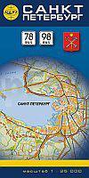
 | Sankt Petersburg StraÃenkarte 1:25.000 Karta LTD Sankt Petersburg Sankt-Peterburg - Karta dlja woditelej |
 | Kosovo Kultur, Natur und Abenteuer für Individualisten - von Kaspar, Martina & Holzmann, Günther - hobo-team.de |
 | Dniprodserschynsker Stausee und Dniproer Stausee - Topographischer Atlas 1:50.000 Dnjeprodserschinskogo i Dneprowskogo Wodochranilisch WKF |
 | 0651-2 TORREJÃN EL RUBIO Topographische Landkarte 1:25.000 Spanien (Grundlage MTN25) Instituto Geográfico Nacional - CNIG Spanien - ProjektNord |
 | CC 3910 Bielefeld Topographische Ãbersichtskarte 1:200.000 - Bundesamt für Kartografie und Geodäsie und Landesvermessungsämter - ProjektNord |
 | 3611 Hopsten (geplottete Ausgabe) Amtliche topographische Karte 1:25.000 Landesvermessungsamt Nordrhein-Westfalen |
 | 154-2 RODEIRO Amtliche topographische Landkarte 1:25.000 Spanien (M.T.N.) 154-2 Mapa Topográfico Nacional de Espana (MTN25) Instituto Geográfico Nacional - CNIG Spanien |
 | L4324 Moringen (geplottete Ausgabe) Topographische Karte 1:50.000 Kartografie Landesvermessungsamt Niedersachsen - ProjektNord |
 | LOIRET - ORLÃANS - MONTARGIS - PITHIVIERS (Blatt D45) Département-Landkarte Frankreich 1:100.000 LOIRET D45 - Carte départementale - IGN Frankreich |
 | Wilna (Nordwest) Touristische Landkarte 1:50.000 (Blatt 3) Vilniaus apylinkes I - Briedis - Litauen |
 | Euro Vélo 6 Atlantique - Mer Noire - de Bâle à Nevers Wanderführer - Mountainbikeführer (französisch) Atlantique - Mer Noire Euro Vélo 6 - de Bâle à Nevers - Grands Itinéraires à Vélo VTT & vélo - carto-guide: fiches+livret pratique Chamina - Frankreich |
 | De syv søstre Topographische Wanderkarte Topo 3000 - 1:50.000 (Blatt 3051) - Nordeca - Norwegen |
 | 3019SB Châteauvillain - Montigny-sur-Aube GPS Amtliche Topographische Wanderkarte Frankreich 1:25.000 - série bleue (IGN) |
 | Radreiseführer Alpe Adria Radweg Von Salzburg bis nach Grado an die Adria mit Extra-Tourenkarte, Reiseführer und exakter Streckenbeschreibung - KOMPASS-Karten |
 | 14 Schoorlse duinen Wanderkarte Forestry commission - 14 Schoorlse duinen Wandelkaart Staatsbosbeheer Falk - Niederlande |
 | 1005-2 ESTEPA Topographische Landkarte 1:25.000 Spanien (Grundlage MTN25) Instituto Geográfico Nacional - CNIG Spanien - ProjektNord |
 | NL 33-01-27 (3227) GroÃglockner Ãsterreichische Karte 1:50.000 mit Wegmarkierungen (topographische Wanderkarte - UTM) - BEV - Ãsterreich |
 | Storslett - Kåfjord - Guolasjavri 1:50.000 Sonderkarte Wanderkarte - Calazo Förlag Schweden |
 | Noord-Holland Noord cycle map region 1:75.000 Fahrradkarte Niederlande Buijten & Schipperheijn |
 | 3854 Vogelsang (Eisenhüttenstadt Ost) Topographische Karte 1:25.000 Landesvermessungsamt Brandenburg (gefaltet) |