| << Russland: Oblaste und Regionen etc. << Rus Co. Ltd. |
||
|
||
Zuletzt angesehene Artikel:
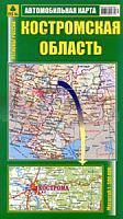
 | Oblast Kostroma 1:500.000 StraÃenkarte / Regionalkarte - Russland Костромская область Rus Co. Ltd. |
 | 0224-2 MELÃN Topographische Landkarte 1:25.000 Spanien (Grundlage MTN25) Instituto Geográfico Nacional - CNIG Spanien - ProjektNord |
 | NM 33-12-19 Ost (5319-Ost) Klosterneuburg Ãsterreichische Karte 1:25.000 mit Wegmarkierungen (topographische Wanderkarte - UTM) - BEV - Ãsterreich - VergröÃerung (ÃK25V) |
 | 1042 07 Parattula Topographische Karte 1:20.000 (Maastokartta / Peruskartta / Grundkarta) Maanmittauslaitos / Lantmäteriverket Finnland - ProjektNord |
 | 6-3 Cabeceiras de Basto - Topographische Landkarte Portugal 1:50.000 Carta Militar de Portugal Instituto Geográfico do Exército (IGeoE) - Portugal |
 | 56 Bromberg - Hohensalza - Karte des Deutschen Reiches 1:100.000 (KDR 100 GB) - GroÃblatt Reichsamt für Landesaufnahme / PreuÃische Landesaufnahme ProjektNord |
 | 2233 07 Jämsä Topographische Karte 1:20.000 (Maastokartta / Peruskartta / Grundkarta) Maanmittauslaitos / Lantmäteriverket Finnland - ProjektNord |
 | Region Altai (Russland) Topographischer StraÃenatlas 1:200.000 - 1:500.000 Алтайский край FGUP-Novosibirskaja kartografičeskaja fabrika |
 | 0285 ALMUDÃVAR Topographische Landkarte 1:50.000 Spanien (Grundlage MTN50) Instituto Geográfico Nacional - CNIG Spanien - ProjektNord |
 | 515-1 PRADOS REDONDOS Amtliche topographische Landkarte 1:25.000 Spanien (M.T.N.) 515-1 Mapa Topográfico Nacional de Espana (MTN25) Instituto Geográfico Nacional - CNIG Spanien |
 | 0586-1 GASCUEÃA Topographische Landkarte 1:25.000 Spanien (Grundlage MTN25) Instituto Geográfico Nacional - CNIG Spanien - ProjektNord |
| 2873 Bromberg (West) Topographische Karte 1:25.000 Messtischblatt des Deutschen Reiches - PreuÃische Landesaufnahme / Reichsamt für Landesaufnahme - Faksimile ProjektNord |
 | 0623-4 LA BAZAGONA Topographische Landkarte 1:25.000 Spanien (Grundlage MTN25) Instituto Geográfico Nacional - CNIG Spanien - ProjektNord |
 | 510 - Topographische Landkarte Portugal 1:25.000 Carta Militar de Portugal - Série M888 Instituto Geográfico do Exército (IGeoE) - Portugal |
 | 226 - Topographische Landkarte Portugal 1:25.000 Carta Militar de Portugal - Série M888 Instituto Geográfico do Exército (IGeoE) - Portugal |
 | 3111 02 Renkomäki Topographische Karte 1:20.000 (Maastokartta / Peruskartta / Grundkarta) Maanmittauslaitos / Lantmäteriverket Finnland - ProjektNord |
 | 1242 10 Pörtom Topographische Karte 1:20.000 (Maastokartta / Peruskartta / Grundkarta) Maanmittauslaitos / Lantmäteriverket Finnland - ProjektNord |
 | 4611 05 Noukavaara Topographische Karte 1:20.000 (Maastokartta / Peruskartta / Grundkarta) Maanmittauslaitos / Lantmäteriverket Finnland - ProjektNord |
 | NL 32-03-30 Ost (2230-Ost) Mayrhofen Ãsterreichische Karte 1:25.000 mit Wegmarkierungen (topographische Wanderkarte - UTM) - BEV - Ãsterreich - VergröÃerung (ÃK25V) |
 | 4332 02 Lieksa Topographische Karte 1:20.000 (Maastokartta / Peruskartta / Grundkarta) Maanmittauslaitos / Lantmäteriverket Finnland - ProjektNord |