Willkommen bei MapFox
Wurde Ihre Bestellung bestätigt? Wenn nicht - gab es evtl. ein SERVER-Problem! Bitte kontaktieren Sie uns! +++ Buchhändler-Anfragen erwünscht +++
Warenkorb
Artikel: 0 - € 0.00
Zur Kasse
Widerruf Impressum Kontakt Versandkosten AGB
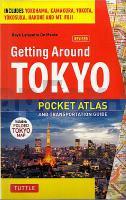
Getting Around Tokyo Pocket Atlas and Transportation Guide Taschenatlas mit herausnehmbarem Stadtplan - Boye Lafayette / De Mente - Tuttle Publishing
<< Japan
<< Periplus
 
Cover

Taschenatlas mit umfangreichen praktischen Informationen über Tokio. Dieses Taschenbuch ist ein äußerst nützliches Handbuch für jeden Tokio-Besucher.

- Herausnehmbarer Innenstadtplan 1:15.000
- Umfassende Erklärung aller Öffentlichen Verkehrsmittel (Liniennetz, Tickets usw.)
- Schwerpunktthema Flughäfen und Anbindung an die Verkehrsmittel
- Detailkarten der Innenstadtdistrikte
- Einzelbeschreibungen der einzelnen Metro-/Bahnlinien
- Detaillierte Anleitung, wie wichtige Ziele erreicht werden können (Disney Resort, Yokohama, Kamakura Area, Hakone, Fuji)

This pocket atlas and Japan travel guide is an indispensable tool for getting around Tokyo - whether as a first-time visitor, or a local resident. The travel book is conveniently divided into chapters that enable the user to know what to do on arriving at Narita or Haneda Airport, and then how to get into and around the city using all available means of public transport.
- Area maps for all the key districts of Tokyo show the locations of hotels, shopping centers, office buildings, temples, shrines, embassies and restaurants as well as their proximity to the nearest subway and JR stations. Information on bus routes and private railways is also given, with detailed diagrams for each route, thus enabling the user to have several options for getting around.
- Places of interest outside Tokyo are also covered: Hakone, Yokohama, Kamakura, Yokosuka, Mt Fuji and Tokyo Disneyland. Numerous area maps (including maps for Yokota, Atsugi and Zama) and diagrams for bus routes and private railways facilitate journeys to all of these destinations.

This Tokyo travel guide contains: Arriving in Tokyo Maps of Tokyo Navigating the Tokyo`s Railway & Subway & Maze Buses Routes Getting Around Yokohama, Kawasaki, Hakone & Kamakura Useful Vocabulary and Expressions

Kartenausschnitt

Kartenbeispiel

Getting Around Tokyo Pocket Atlas and Transportation Guide Taschenatlas mit herausnehmbarem Stadtplan - Boye Lafayette / De Mente - Tuttle Publishing
EAN / ISBN: 9784805309650
Preis: EUR 27.90

Bestellartikel: versandfertig in ca. 2 Wochen oder länger. Dieser Artikel wird speziell für Sie bestellt. Keine Rücknahme!
Produkt EUR Anzahl Bestellen
Getting Around Tokyo Pocket Atlas and Transportation Guide Taschenatlas mit herausnehmbarem Stadtplan - Boye Lafayette / De Mente - Tuttle Publishing 27.90
Versandkostenfrei in Deutschland ab 30,- Bestellwert

incl. MwSt.

Stichworte, die bei der Suche nützlich sein könnten:
Tokio - Tokyo - Tokio Reiseführer - Japan - Tokyo Reiseatlas - Japan - Japan - Japan Kartographie - Japan Reiseführer - Japan Wanderkarten - Japankarten - Japan Straßenkarten - Japan Atlanten - Japan Karten - Japan Landkartenverkauf - Japan Landkarten - Japan Fahrradkarten - Japan Kartografie - Japan Radwanderführer - Japan Radwanderkarten - Periplus Editors - Periplus Landkarten - Periplus Karten - Tuttle Publishing - Australien - China - Taiwan - Indien - Indonesien - Malaysia - Philippinen - Singapur - Japan - Korea - Thailand - Australien Landkarten - China Landkarten - Taiwan Landkarten - Indien Landkarten - Indonesien Landkarten - Malaysia Landkarten - Philippinen Landkarten - Singapur Landkarten - Japan Landkarten - Korea Landkarten - Thailand Landkarten

Zuletzt angesehene Artikel:

CoverGetting Around Tokyo Pocket Atlas and Transportation Guide Taschenatlas mit herausnehmbarem Stadtplan - Boye Lafayette / De Mente - Tuttle Publishing

Cover4727 Küllstedt Topographische Karte Thüringen 1:25.000 Landesvermessungsamt Thüringen

Cover5137 Münchenbernsdorf Topographische Karte Thüringen 1:25.000 Landesvermessungsamt Thüringen

CoverHistorische WELTKARTE - KOLONIALKARTE 1910 - Historische Landkarte - PLANO gerollt - Verlag Rockstuhl

Cover2637 Marnitz Topographische Karte 1:25.000 Landesvermessungsamt Brandenburg (gefaltet)

CoverThe South West Coast Path Vol 2: Map Booklet 1:25.000 St Ives to Plymouth - Southern England - Cicerone Großbritannien (englisch)

Noch kein Cover vorhanden2031SB Limoges Amtliche Topographische Wanderkarte Frankreich 1:25.000 - série bleue (IGN)

Cover46/3-4 PONT-A-CELLES - LES BONS VILLERS NGI 1:25.000 Topographische Landkarte Belgien

Cover57/3-4 FROIDCHAPEL - SENZEILLES NGI 1:25.000 Topographische Landkarte Belgien

CoverBeraun - Rokytzan 1:12.000 Stadtpläne
Beroun - Rokycany SHOCart Tschechien

Cover4447 Rückersdorf Sonderausgabe mit Wanderwegen - Topographische Wanderkarte Brandenburg 1:25.000 ProjektNord

CoverShort Walks in Lakeland Book 3: West Lakeland Wanderführer Lake District - Cicerone Großbritannien (englisch)

Cover25 Te Anau Topographische Landkarte Neuseeland 1:250.000 Land Information New Zealand

Cover08 Zürcher Unterland - Winterthur - Wanderkarte Schweiz 1:40.000 wasserfest - Kümmerly & Frey

Noch kein Cover vorhanden2342SB REALMONT - ALBAN GPS Amtliche Topographische Wanderkarte Frankreich 1:25.000 - série bleue (IGN)

Cover2738 Putlitz Topographische Karte 1:25.000 Landesvermessungsamt Brandenburg (gefaltet)

CoverAndalucia & Costa del Sol & Sierras Sunflower-Wanderführer - englisch - kostenlose Updates - car tours & walks

Noch kein Cover vorhandenMerced / Madera / Atwater / Los Banos Stadtplan 1:32.000 (Kalifornien - USA)
Merced / Madera / Atwater / Los Banos street map GM Johnson

CoverMauretanien entdecken - Reiseführer durch die Wüste Westafrikas - von Sonntag, Beatrice - BoD - Books on Demand

CoverIndien Nordwest Landkarte (Blatt 3013) AdventureMap wasserfest
India Northwest National Geographic
