| << Kompass Karten << Schnäppchen - Restposten - Mängelexemplare |
  | |
|
||
Zuletzt angesehene Artikel:
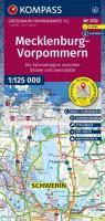
![]() | Mecklenburg-Vorpommern 1:125:000 (Nr. 3702) *** SCHNÄPPCHEN *** Großraum-Radtourenkarte - KOMPASS-Karten |
![]() | 4523 12 Lämsänkylä Topographische Karte 1:20.000 (Maastokartta / Peruskartta / Grundkarta) Maanmittauslaitos / Lantmäteriverket Finnland - ProjektNord |
![]() | 77-3 TORRESTÍO Amtliche topographische Landkarte 1:25.000 Spanien (M.T.N.) 77-3 Mapa Topográfico Nacional de Espana (MTN25) Instituto Geográfico Nacional - CNIG Spanien |
![]() | 3612 Mettingen - Wanderkarte mit Wanderwegen (geplottete Ausgabe) ProjektNord - Grundlage Amtliche topographische Karte 1:25.000 Landesvermessungsamt Nordrhein-Westfalen |
![]() | 3233 03 Lahnalahti Topographische Karte 1:20.000 (Maastokartta / Peruskartta / Grundkarta) Maanmittauslaitos / Lantmäteriverket Finnland - ProjektNord |
![]() | 981-1 SAN BARTOLOME DE LA TORRE Amtliche topographische Landkarte 1:25.000 Spanien (M.T.N.) 981-1 Mapa Topográfico Nacional de Espana (MTN25) Instituto Geográfico Nacional - CNIG Spanien |
![]() | 2121 06 Suodenniemi Topographische Karte 1:20.000 (Maastokartta / Peruskartta / Grundkarta) Maanmittauslaitos / Lantmäteriverket Finnland - ProjektNord |
![]() | 2221 03 Luopa Topographische Karte 1:20.000 (Maastokartta / Peruskartta / Grundkarta) Maanmittauslaitos / Lantmäteriverket Finnland - ProjektNord |
![]() | 8039 Bad Endorf Topographische Landkarte Bayern 1:25.000 - Normalausgabe - ProjektNord (geplottete Ausgabe) - Grundlage amtliche Topographische Karte Bayern DTK25 |
![]() | 2492 Ortelsburg (Ost) Topographische Karte 1:25.000 Messtischblatt des Deutschen Reiches - Preußische Landesaufnahme / Reichsamt für Landesaufnahme - Faksimile ProjektNord |
![]() | NL 32-03-24 West (2224-West) Schwaz Österreichische Karte 1:25.000 mit Wegmarkierungen (topographische Wanderkarte - UTM) - BEV - Österreich - Vergrößerung (ÖK25V) |
![]() | 3741 07 Lätäkkövaara Topographische Karte 1:20.000 (Maastokartta / Peruskartta / Grundkarta) Maanmittauslaitos / Lantmäteriverket Finnland - ProjektNord |
![]() | 315-4 Huerta del Rey Amtliche topographische Landkarte 1:25.000 Spanien (M.T.N.) 315-4 Mapa Topográfico Nacional de Espana (MTN25) Instituto Geográfico Nacional - CNIG Spanien |
![]() | 381-2 TRASOBARES Amtliche topographische Landkarte 1:25.000 Spanien (M.T.N.) 381-2 Mapa Topográfico Nacional de Espana (MTN25) Instituto Geográfico Nacional - CNIG Spanien |
![]() | 47-4 COSPEITO Amtliche topographische Landkarte 1:25.000 Spanien (M.T.N.) 47-4 Mapa Topográfico Nacional de Espana (MTN25) Instituto Geográfico Nacional - CNIG Spanien |
![]() | Kreis Köslin - Touristische Landkarte der Naturschutzgebiete 1:75.000 Touristische Landkarte, Wanderkarte - Polen Powiat koszaliński - mapa przyrodnicza EKO-Map - Polen |
![]() | NL 33-05-01 West (4101-West) Flattnitz *** SCHNÄPPCHEN *** Österreichische Karte 1:25.000 mit Wegmarkierungen (topographische Wanderkarte - UTM) - BEV - Österreich - Vergrößerung (ÖK25V) |


