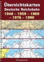
| << Deutschland: Historische Karten und Stadtpläne (im Bereich der heutigen Bundesrepublik) << Rockstuhl |
  | |
Zuletzt angesehene Artikel:
![]() | Übersichtskarten der DEUTSCHEN REICHSBAHN 1948 - 1959 - 1969 - 1976 - 1990 Übersichtskarte 1969 zum Kursbuch der Deutschen Bundesbahn und der Deutschen Reichsbahn von gesamt Deutschland - Verlag Rockstuhl |
![]() | Eisenach (Blatt 4) *** SCHNÄPPCHEN *** Topographische Wanderkarte Thüringen 1:25.000 - Thüringer Landesvermessungsamt - Wanderkarte mit Wanderwegen |
![]() | 137 Lamego - Topographische Landkarte Portugal 1:25.000 Carta Militar de Portugal - Série M888 Instituto Geográfico do Exército (IGeoE) - Portugal |
![]() | Danzig - Gdingen - Zoppot 1:26.000 Laminierter Stadtplan Gdansk, Gdynia, Sopot Trojmiasto ExpressMap Polen |
![]() | 322.24 Amtliche topographische Karte 1:25.000 Polen |
![]() | Oblast Uljanowsk Topografischer Atlas 1:200.000 Uljanovskaja oblastj - Russland |
![]() | 11 España suroeste Landkarte 1:500.000 Straßenkarte Spanien - CNIG Centro Nacional de Información Geográfico |
![]() | V5112 Mutenia Topographische Karte 1:25.000 EUREF (Peruskartta) Maanmittauslaitos / Lantmäteriverket Finnland - ProjektNord |
![]() | 6023 Lohr am Main Topographische Landkarte Bayern 1:25.000 - Normalausgabe - ProjektNord (geplottete Ausgabe) - Grundlage amtliche Topographische Karte Bayern DTK25 |
![]() | L3314 Vechta (geplottete Ausgabe) Topographische Karte 1:50.000 Kartografie Landesvermessungsamt Niedersachsen - ProjektNord |
![]() | L3514 Damme (geplottete Ausgabe) Topographische Karte 1:50.000 Kartografie Landesvermessungsamt Niedersachsen - ProjektNord |
![]() | Q4211 Lohtaja Topographische Karte 1:25.000 EUREF (Peruskartta) Maanmittauslaitos / Lantmäteriverket Finnland - ProjektNord |
![]() | 1434 III Hekkingen Amtliche Topographische Karte Norwegen 1:50.000 - Statens Kartverk - Norwegen |
![]() | 7931 Landsberg am Lech Topographische Landkarte Bayern 1:25.000 - Normalausgabe - ProjektNord (geplottete Ausgabe) - Grundlage amtliche Topographische Karte Bayern DTK25 |
![]() | Q532 Lauvuskylä Topographische Karte 1:50.000 EUREF-FIN (Maastokarttat) Maanmittauslaitos / Lantmäteriverket Finnland - ProjektNord |
![]() | Kleine Rennsteiggeschichten (Golchert) - Grünes Herz |
![]() | U4443 Topographische Karte 1:25.000 EUREF (Peruskartta) Maanmittauslaitos / Lantmäteriverket Finnland - ProjektNord |
![]() | Parnitha (Blatt 1.1) Topografische Bergwanderkarte Attika - Griechenland 1:25.000 - Greece - Attica Παρνηθα - Mt. Parnitha - ΠΕΖΟΠΟΡΙΚΟΣ ΧΑΡΤΗΣ - Hiking Map - Anavasi - Griechenland |
![]() | Kaspisches Meer - Generalkarte 1:4 Mio. (Blatt 1652) Landkarte / Straßenkarte Englisch und Persisch General map of the Caspian Sea - نقشه عمومي درياي خزر Gitashenasi - Iran |
![]() | 3350 Reichenow - Möglin Sonderausgabe mit Wanderwegen - Topographische Wanderkarte Brandenburg 1:25.000 ProjektNord |


