
| << Deutschland: Historische Karten und Stadtpläne (im Bereich der heutigen Bundesrepublik) << Rockstuhl |
||
|
||
Zuletzt angesehene Artikel:
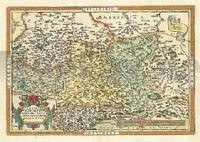
 | Sachsen - Meißen - Thüringen (Criginger) 1570 - Historische Landkarte Nachdruck Planokarte - gerollt von Abraham Ortelius - Verlag Rockstuhl |
 | 464.33 Amtliche topographische Karte 1:25.000 Polen |
 | Kanalinseln (Band 31) 32 Wanderungen im Rhythmus der Gezeiten - von Meier, Markus , Janina - Conrad Stein Verlag GmbH |
| 195 S Loppa SØR 1:50.000 - Topographische Landkarte Norwegen - ProjektNord - Startens Kartverk |
 | Menorca Wanderkarte und Fahrradkarte 1:40.000 Tour & Trail (wasserfest) Discovery Walking Guides Ltd Menorca Tour & Trail Map (Super-Durable) |
| 351.11 Amtliche topographische Karte 1:25.000 Polen |
| 52 Zabrezko - Moravska Trebova, Mohelnice, Unicov, Litovel Wanderkarte Tschechien 1:50.000 - KCT - Papierausgabe 52 Zábřežsko - Moravská Třebová, Mohelnice, Uničov, Litovel |
| 222.44 Amtliche topographische Karte 1:25.000 Polen |
 | Romanische Kunst im Zentralmassiv Découvertes régionales - Culture & Environnement L´art roman dans le Massif central IGN Frankreich |
 | Marokko Nelles-Reiseführer Nelles-Verlag |
 | Hue - Na Dang und Zentral-Vietnam 1:800.000 Straßenkarte Hue and Central Vietnam ITMB International Travel Maps (engl.) |
 | 6211 Bad Sobernheim Topographische Karte 1:25.000 - Landesamt für Vermessung und Geobasisinformation Rheinland-Pfalz |
 | Europa 1:4.5 Mio. politisch Straßenkarte Kümmerly + Frey |
| N-34-80-A/B Ryn Amtliche topographische Landkarte Polen 1:50.000 N-34-80-A/B Ryn - Mapa Topograficzna Polski Glowny Geodeta Kraju |
| 262.3 Amtliche topographische Karte 1:50.000 Polen |
 | N32 Topographische Karte 1:100.000 EUREF-FIN Maanmittauslaitos / Lantmäteriverket Finnland - ProjektNord |
 | Caribbean National Forest Trail Map (Blatt: 790) Landkarte Trails Illustrated Map National Geographic - USA |
 | 4 Fichtelgebirge - Hof - Bayreuth - Landkarte 1:100.000 (ATK100) Amtliche topographische Karte Bayern - Landesvermessungsamt Bayern |
 | L313 Korpo Topographische Karte 1:50.000 EUREF-FIN (Maastokarttat) Maanmittauslaitos / Lantmäteriverket Finnland - ProjektNord |
 | 218 Umgebung Brünn Süd - Lundenburg - Göding Touristische Landkarte Tschechien 1:100.000 Okolí Brna jih - Břeclavsko - Hodonínsko - SHOCart |