| << Deutschland: Wassersportkarten, Wassersportatlanten und Wassersportführer << Thomas Kettler Verlag - Kanuführer |
  | |
Zuletzt angesehene Artikel:
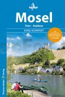
![]() | Kanu Kompakt Mosel Mit topografischen Wasserwanderkarten 1:75.000 - von Stefan Schorr - Thomas Kettler Verlag |
![]() | 188 Maidstone & Royal Tunbridge Wells - Wanderkarte Großbritannien 1:50.000 Active Laminiert LANDRANGER MAP - Ordnance Survey |
![]() | 2029SB Bessines-sur-Gartempe - Magnac-Laval GPS Amtliche Topographische Wanderkarte Frankreich 1:25.000 - série bleue (IGN) |
![]() | Südgeorgien und die Shackleton Durchquerung 1:200.000 / 1:40.000 Landkarte British Antarctic Survey South Georgia and The Shackleton Crossing |
![]() | Big Sur - Ventana Wilderness - Los Padre (Blatt: 814) Landkarte Trails Illustrated Topographic Map National Geographic - USA |
![]() | 2043 Dargun N Amtliche Topographische Karte 1:25.000 Landesvermessungsamt Mecklenburg-Vorpommern |
![]() | 2436 Wessin Amtliche Topographische Karte 1:25.000 Landesvermessungsamt Mecklenburg-Vorpommern |
![]() | 064 Glasgow, Motherwell & Airdrie - Wanderkarte Großbritannien 1:50.000 Active Laminiert LANDRANGER MAP - Ordnance Survey |
![]() | 1742 Velgast Amtliche Topographische Karte 1:25.000 Landesvermessungsamt Mecklenburg-Vorpommern |
![]() | Stadtplan Frankfurt (Oder) und Slubice Stadtplan 1:20.000. Detaillierter Plan der Innenstadt 1:8000 - von Bloch, Dirk (Kartograf) - BLOCHPLAN |


