 Detaillierte Naturbeobachtungen & persテカnliche Schilderungen seiner Erlebnisse zwischen der Ortschaft Sisimiut und der Halbinsel Nテサssuaq. In vielerlei Hinsicht ein Land der Superlative, ist Grテカnland ein Traumziel fテシr den Liebhaber von weiter Tundra, rauem Gebirge und groテ歹r Stille. Bisher nur punktuell touristisch besser erschlossen, hテ、lt die Insel weite Gebiete zur eigenstテ、ndigen Erkundung und zum Erleben von allerlei Abenteuer bereit. Vorurteil, das Klima sei zu schlecht und die Infrastruktur der Insel nur schwer zu erschlieテ歹n, sind ebenso unangebracht wie die Meinung, Grテカnland lieテ歹 sich nur von "harten Abenteurernaturen" im aufwテ、ndigen Expeditionsstil bereisen. Sorgfテ、ltige Vorbereitung und eine gewisse Erfahrung vorausgesetzt, bieten sich gerade fテシr Kajakfahrten optimale Verhテ、ltnisse, da die weitrテ、umigen Gefilde vor allem dem Wasserwanderer zugテ、nglich werden.
|
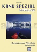
Kanu Spezial Grテカnland - Reisebericht Sommer an der Westkテシste. Reisebericht - von Philipp Krekel - Thomas-Kettler-Verlag
EAN / ISBN: 9783934014152
Preis: EUR 9.90
|
|

