| << Deutschland: Historische Karten und Stadtpläne (im Bereich der heutigen Bundesrepublik) << Rockstuhl |
||
|
||
Zuletzt angesehene Artikel:
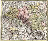
 | Amt Eisenach und der Thüringer Wald / Wartburg 1716 - Historische Landkarte Nachdruck Planokarte - gerollt von Homann, J. Baptist - Verlag Rockstuhl |
 | 4010 Nottuln - Wanderkarte mit Wanderwegen (geplottete Ausgabe) ProjektNord - Grundlage Amtliche topographische Karte 1:25.000 Landesvermessungsamt Nordrhein-Westfalen |
 | 5308 Bonn - Bad Godesberg - Wanderkarte mit Wanderwegen (geplottete Ausgabe) ProjektNord - Grundlage Amtliche topographische Karte 1:25.000 Landesvermessungsamt Nordrhein-Westfalen |
 | 5206 Erp - Wanderkarte mit Wanderwegen (geplottete Ausgabe) ProjektNord - Grundlage Amtliche topographische Karte 1:25.000 Landesvermessungsamt Nordrhein-Westfalen |
 | Drôme à Vélo Fahrradkarte 1:100.000 Freizeit und Ausflugs-Landkarte Plein Air - IGN Frankreich La Drôme à Vélo (2) cyclocarte - Carte de Loisirs de Plein Air |
 | 5102 Herzogenrath - Wanderkarte mit Wanderwegen (geplottete Ausgabe) ProjektNord - Grundlage Amtliche topographische Karte 1:25.000 Landesvermessungsamt Nordrhein-Westfalen |
 | 475 Lumbrales Amtliche topographische Landkarte 1:50.000 Spanien (M.T.N.) 475 Mapa Topográfico Nacional de Espana (MTN50) Instituto Geográfico Nacional - CNIG Spanien |
 | 5506 Aremberg - Wanderkarte mit Wanderwegen (geplottete Ausgabe) ProjektNord - Grundlage Amtliche topographische Karte 1:25.000 Landesvermessungsamt Nordrhein-Westfalen |
 | 5404 Schleiden - Wanderkarte mit Wanderwegen (geplottete Ausgabe) ProjektNord - Grundlage Amtliche topographische Karte 1:25.000 Landesvermessungsamt Nordrhein-Westfalen |
 | 5208 Bonn - Wanderkarte mit Wanderwegen (geplottete Ausgabe) ProjektNord - Grundlage Amtliche topographische Karte 1:25.000 Landesvermessungsamt Nordrhein-Westfalen |
 | 5830 Pfarrweisach Topographische Landkarte Bayern 1:25.000 - Normalausgabe - ProjektNord (geplottete Ausgabe) - Grundlage amtliche Topographische Karte Bayern DTK25 |
 | Yorkshire Dales: Dales East Wanderkarte 1:40.000 Von Masham nach Ilkley, inkl. Pately Bridge - Outdoor map - HARVEY MAPS Yorkshire Dales: Dales East - Covers the area from Masham to Ilkley, including Pately Bridge - Outdoor map |
 | 5935 Marktschorgast Topographische Landkarte Bayern 1:25.000 - Normalausgabe - ProjektNord (geplottete Ausgabe) - Grundlage amtliche Topographische Karte Bayern DTK25 |
 | 5108 Köln-Porz - Wanderkarte mit Wanderwegen (geplottete Ausgabe) ProjektNord - Grundlage Amtliche topographische Karte 1:25.000 Landesvermessungsamt Nordrhein-Westfalen |
 | 220 Umgebung Brünn (Ost) - Drahaner Bergland - Olmütz Touristische Landkarte Tschechien 1:100.000 Okolà Brna - východ, Drahanská Vrchovina - Olomoucko - SHOCart |
 | 5930 Ebern Topographische Landkarte Bayern 1:25.000 - Normalausgabe - ProjektNord (geplottete Ausgabe) - Grundlage amtliche Topographische Karte Bayern DTK25 |
 | 7645 Rotthalmünster Topographische Landkarte Bayern 1:25.000 - Normalausgabe - ProjektNord (geplottete Ausgabe) - Grundlage amtliche Topographische Karte Bayern DTK25 |
 | 5831 SeÃlach Topographische Landkarte Bayern 1:25.000 - Normalausgabe - ProjektNord (geplottete Ausgabe) - Grundlage amtliche Topographische Karte Bayern DTK25 |
 | 5937 Fichtelberg Topographische Landkarte Bayern 1:25.000 - Normalausgabe - ProjektNord (geplottete Ausgabe) - Grundlage amtliche Topographische Karte Bayern DTK25 |
 | 5924 Gemünden am Main Topographische Landkarte Bayern 1:25.000 - Normalausgabe - ProjektNord (geplottete Ausgabe) - Grundlage amtliche Topographische Karte Bayern DTK25 |