| << Bayern: Topographische Karte 1:25.000 (ATK25) - Bayrisches Landesamt für Digitalisierung, Breitband und Vermessung (Landesvermessungsamt) |
  | |
|
||
Zuletzt angesehene Artikel:
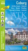
![]() | B09 Coburg - Ahorn - Rödental - Lautertal - Meeder - Neustadt b.Coburg ATK25 Topographische Karte 1:25.000 (Atkis) Bayern Landesvermessungsamt Bayern - Wanderkarte |
![]() | 1291 BOSCO-GURIN 1:25.000 - Wandfluhhorn / Pizzo Bìla - Valle di Campo - Cevio - Topographische Landeskarte der Schweiz - swisstopo |
![]() | 2511-III-SØ Topographische Karte Dänemark 1:25.000 Topografisk kort Danmark (DTK/Kort25) 2511-III-SØ ProjektNord - Kort & Matrikelstyrelsen / Geodætisk Institut |
![]() | Radwanderkarte - Region Lublin - Kazimierz Dolny Radwanderkarte 1:50.000 (Blatt 367) Szlaki rowerowe REGION LUBELSKI - Lublin - Kazimierz Dolny Cartomedia |
![]() | Zegrze-Stausee und Umgebung Topographische Wanderkarte Polen 1:50.000 Jezioro Zegrzyńskie i okolice Compass - Polen |
![]() | Europa politisch Antik Laminierte PLANO-Karte 1:8.4 Mio. (Format: 77 x 60 cm) - gerollt im Plastikrohr Europe political antique flat map - laminated National Geographic |
![]() | 66-1 Urdazubi/Urdax Amtliche topographische Landkarte 1:25.000 Spanien (M.T.N.) 66-1 Mapa Topográfico Nacional de Espana (MTN25) Instituto Geográfico Nacional - CNIG Spanien |
![]() | Mosbach - Neckarsulm (Blatt 03) Wandern und Radfahren - Topographische Wanderkarte 1:35.000 mit Radwegen und touristischen Informationen - Landesvermessungsamt Baden-Württemberg |
![]() | M08 Augsburg - Neusäß, Gersthofen, Diedorf, Langweid a.Lech, Welden, Stadtbergen ATK25 Topographische Karte 1:25.000 (Atkis) Bayern Landesvermessungsamt Bayern - Wanderkarte |
![]() | 146 Angoulême - Bellac Topographische Touristische Landkarte Tourismus und Fahrrad (wasserfest) - tourisme et vélo plastifiée TOP100 - 1:100.000 - IGN Frankreich |
![]() | Arzachena *** SCHNÄPPCHEN *** Topographische Wanderkarte Sardinien 1:30.000 (deu./engl./frz./ital.) Carta turistico-escursionistica di Arzachena Edizioni Abies |
![]() | F06 Uffenheim mit Iphofen, Markt Einersheim, Mainbernheim, Ippesheim, Markt Bibart, Sugenheim ATK25 Topographische Karte 1:25.000 (Atkis) Bayern Landesvermessungsamt Bayern - Wanderkarte |
![]() | 4575 Plugawice Topographische Karte 1:25.000 Messtischblatt des Deutschen Reiches - Preußische Landesaufnahme / Reichsamt für Landesaufnahme - Faksimile ProjektNord |
![]() | U4243 Aakenustunturi Topographische Karte 1:25.000 EUREF (Peruskartta) Maanmittauslaitos / Lantmäteriverket Finnland - ProjektNord |
![]() | R05 Oberstaufen - Alpsee, Missen-Wilhams, Oberreute, Grünenbach, Balderschwang, Nagelfluhkette ATK25 Topographische Karte 1:25.000 (Atkis) Bayern Landesvermessungsamt Bayern - Wanderkarte |
![]() | 1099-II (Fuerteventura) Los Verodes Amtliche topographische Landkarte 1:25.000 Spanien (M.T.N.) 1099-II Mapa Topográfico Nacional de Espana (MTN25) Instituto Geográfico Nacional - CNIG Spanien |
![]() | C01 Alzenau - Mömbris, Kahl a. Main, Aschaffenburg, Hösbach, Goldbach, Schöllkrippen ATK25 Topographische Karte 1:25.000 (Atkis) Bayern Landesvermessungsamt Bayern - Wanderkarte |
![]() | Osiglia - Bardineto - Murialdo e Bormida - Provincia di Savona (Blatt SV-6) Topographische Wanderkarte 1:25.000 Carta dei Sentieri EdM - Edizioni del Magistero - Italien |
![]() | 5717 Bad Homburg vor der Höhe - Wanderkarte mit Wanderwegen (geplottete Ausgabe) Topographische Landkarte Hessen 1:25.000 - ProjektNord (geplottete Ausgabe) |


