  Blattschnitte Thüringen Blattschnitte Thüringen
Im nordwestlichen Teil des Thüringer Beckens gelegen, umschließen der Hainich und der Dün den Unstrut-Hainich-Kreis. Der Hainich besitzt das größte zusammenhängende Laubwaldgebiet Europas mit seltenen vom Aussterben bedrohten Tieren. Als Nationalpark, eingebettet in den Naturpark Eichsfeld-Hainich-Werratal kann sich hier die Tier- und Pflanzenwelt ungestört entwickeln.
Die Region hat ein umfangreiches Rad-und Wanderwegenetz und eine Vielzahl von Ausflugszielen laden zum entdecken ein. Ein besonderes Highlight ist der Baumkronenpfad der auf 534 Metern einen herrlichen Panorama-Blick und viel Wissenswertes über die Flora und Fauna des Hainich ermöglicht.
Die neue Reiß- und Wetterfeste Rad- und Wanderkarte ´Unstrut-Hainich-Kreis´ stellt den Landkreis mit dem Rad- und Wanderwegenetz vor und schließt an die Rad- und Wanderkarte Landkreis Eichsfeld, Wartburgkreis und Kyffhäuserkreis an.Zusätzlich werden auch die von der Funke Mediengruppe initiierten Stempelstellen ´Touringen entdecken´ mit Signaturen und der dazu gehörenden Nummer dargestellt. Dies ermöglicht den ´Stempeljägern´ die punktgenaue Erwanderung der Stempelstellen.
Ein integriertes UTM-Gitter ermöglicht die Orientierung im Gelände mit Hilfe eines GPS- Gerätes und eine Geländeschummerung visualisiert das Mittelgebirge. Kartenausschnitt
Kartenbeispiel
|
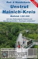
Unstrut-Hainich-Kreis 1:50.000 Wanderkarte + Radwanderkarte Thüringen KKV - Kartographische Kommunale Verlagsgesellschaft
EAN / ISBN: 9783869732695
Preis: EUR 6.00
|
|


