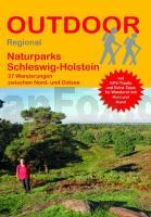
| << Schleswig-Holstein: Reiseführer und Wanderführer << Conrad-Stein-Verlag |
  | |
Zuletzt angesehene Artikel:
![]() | Naturparks Schleswig-Holstein - 27 Wanderungen zwischen Nord- und Ostsee - Band 428 - von Tonia Körner - Stein, Conrad, Verlag |
![]() | Yogyakarta 1:15.000/1:30.000 - Umgebung Yogyakarta 1:100.000 Straßenkarte Yogyakarta Travel Map Periplus Editors |
![]() | CC 8742 Bad Reichenhall Topographische Übersichtskarte 1:200.000 - Bundesamt für Kartografie und Geodäsie und Landesvermessungsämter - ProjektNord |
![]() | 2113-IV-SV Topographische Karte Dänemark 1:25.000 Topografisk kort Danmark (DTK/Kort25) 2113-IV-SV ProjektNord - Kort & Matrikelstyrelsen / Geodætisk Institut |
![]() | Jostedalsbreen nasjonalpark - Olden - Briksdalsbreen - Jostedalen - Nigardsbreen - Mørkisdalen Topographische Wanderkarte Topo 3000 - 1:50.000 (Blatt 3009) - Nordeca - Norwegen |
![]() | L331 Nagu Topographische Karte 1:50.000 EUREF-FIN (Maastokarttat) Maanmittauslaitos / Lantmäteriverket Finnland - ProjektNord |
![]() | 0718-3 LEDAÑA Topographische Landkarte 1:25.000 Spanien (Grundlage MTN25) Instituto Geográfico Nacional - CNIG Spanien - ProjektNord |
![]() | 21-211 Topographische Karte 1:25.000 der Tschechischen Republik Zakladní mapa Ceská republika Cesky urad zememericky a katastralni - ProjektNord |
![]() | 1067-1 TORREMOLINOS Topographische Landkarte 1:25.000 Spanien (Grundlage MTN25) Instituto Geográfico Nacional - CNIG Spanien - ProjektNord |
![]() | Osteuropa 1:2 Mio. Auto- + Freizeitkarte Eastern Europe - Europa del Este - Oost Europa - Europa de l` Est - Europa orienta freytag & berndt |
![]() | NK 38-10 Kars Amtliche Topographische Karte der Türkei 1:250.000 NK 38-10 Kars - Müşterek Harekat Haritası HGK |
![]() | U5413 Ulmakuusikko Topographische Karte 1:25.000 EUREF (Peruskartta) Maanmittauslaitos / Lantmäteriverket Finnland - ProjektNord |
![]() | 33 Rochehaut - Vresse-sur-Semois - Sugny - Paliseul - 1:25.000 Touristische Landkarte und Wanderkarte, Radwanderkarte, Reitkarte - Mini Ardenne - Belgien |
![]() | M-34-79-A/B Tuchow Amtliche topographische Landkarte Polen 1:50.000 M-34-79-A/B Tuchow - Mapa Topograficzna Polski Glowny Geodeta Kraju |
![]() | 4818 Medebach - Wanderkarte mit Wanderwegen (geplottete Ausgabe) Topographische Landkarte Hessen 1:25.000 - ProjektNord (geplottete Ausgabe) |
![]() | 3741 12 Marjavaara Topographische Karte 1:20.000 (Maastokartta / Peruskartta / Grundkarta) Maanmittauslaitos / Lantmäteriverket Finnland - ProjektNord |
![]() | 0279-2 VILLOSLADA DE CAMEROS Topographische Landkarte 1:25.000 Spanien (Grundlage MTN25) Instituto Geográfico Nacional - CNIG Spanien - ProjektNord |
![]() | 0728-1 CAMPO MACÍAS Topographische Landkarte 1:25.000 Spanien (Grundlage MTN25) Instituto Geográfico Nacional - CNIG Spanien - ProjektNord |
![]() | 0220-2 MAS PILS Topographische Landkarte 1:25.000 Spanien (Grundlage MTN25) Instituto Geográfico Nacional - CNIG Spanien - ProjektNord |
![]() | 23-112 Topographische Karte 1:25.000 der Tschechischen Republik Zakladní mapa Ceská republika Cesky urad zememericky a katastralni - ProjektNord |


