Willkommen bei MapFox
Wurde Ihre Bestellung bestätigt? Wenn nicht - gab es evtl. ein SERVER-Problem! Bitte kontaktieren Sie uns! +++ Buchhändler-Anfragen erwünscht +++
Warenkorb
Artikel: 0 - € 0.00
Zur Kasse
Widerruf Impressum Kontakt Versandkosten AGB
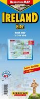
Ireland 1:700.000 Straßenkarte Berndtson
<< Irland
<< Berndtson
 
Cover

Wasserfeste Landkarte, GPS-tauglich.

Cork, Dublin, Dublin+, Wicklow Mountains, Time Zone (BerndtsonMAP) (Road Map/ Landkarte) [Folded Map/ Faltkarte]

BerndtsonMAP is a watersafe, durable, laminated and easy to fold road map. The BerndtsonMAP features overview and detail maps with elaborate road and street network, points of interest, public facilities, hotels, shopping centers and markets, including a time zone map as well as useful statistics, temperature, weight and measurement conversion charts, climate charts with temperatures, sunshine hours, precipitation and humidity. Special feature of the BerndtsonMAP is a selection of the 15 most popular POIs (points of interest) shown in a LocatorMAP and with short text description including opening hours and useful web-sites.

Kartenausschnitt

Kartenbeispiel

Ireland 1:700.000 Straßenkarte Berndtson
EAN / ISBN: 9783865925626
Preis: EUR 9.90

Bestellartikel: versandfertig in ca. 3-7 Tagen. Dieser Artikel wird speziell für Sie bestellt. Keine Rücknahme!
Produkt EUR Anzahl Bestellen
Ireland 1:700.000 Straßenkarte Berndtson 9.90
Versandkostenfrei in Deutschland ab 30,- Bestellwert

incl. MwSt.

Stichworte, die bei der Suche nützlich sein könnten:
Irland - Ireland - Irland Landkarte - Berndtson - Berndtson & Berndtson - Berndson - Berndtson Landkarten - Berndtson Länderkarten - Berndtson Stadtpläne - Berndtson Citypläne - Berndtson City-Pläne - Berndtson maps - Berndtson city maps - Irland Landkarten - Ireland road maps - Irland

Zuletzt angesehene Artikel:

CoverIreland 1:700.000 Straßenkarte Berndtson

CoverChiemgau - Die schönsten Alm- und Gipfelwanderungen 60 Touren - Rother Wanderführer - Bergverlag Rother

CoverTenerife: Road Map - Hiking Paths - Tourist Information 1:75.000 Turquesa Publicaciones

CoverTorridon XT40 - Wanderkarte 1:40.000 ultra harvey - HARVEY MAPS

CoverThe Wales Coast Path - Llwybr - Arfordir - Cymru - Wanderführer - Cicerone (englisch)

CoverTanzania Travel Guide Reiseführer (englisch) Bradt Publications

CoverTürkei - Zypern - Türkische Riviera 1:900.000 / 1:2 Mio.
Turkey, Cyprus, Turkish Riviera - Internationale Landkarte - Cartographia

CoverCityTrip Weimar Reiseführer mit Stadtplan und kostenloser Web-App - von Martin Schmidt - Reise Know-How

CoverAntigua + Barbuda 1:30.000 / 1:35.000 - Landkarte - Street map - GMP - Geographic Map Publishing - midok - Michal Kasprowsky

Noch kein Cover vorhanden4348-SW Topographische Karte 1:10.000 - Landesvermessungsamt Brandenburg

CoverCamino Inglés and Ruta do Mar To Santiago de Compostela - from Ferrol, A Coruña or Ribadeo - Wanderführer Cicerone Großbritannien (englisch)

CoverIndien Nordwest 1:1.3 Mio. Landkarte Reise-Know-How Verlag - world mapping project

CoverBuenos Aires CityTrip - von Maike Christen - Reise Know-How Verlag

CoverSlowakei Straßenkarte 1:300.000
Slovensko SHOCart

Cover4 Gstaad - Outdoor - Winter-Erlebniskarte 1:40.000 Hallwag

CoverSomerset - go slow Reiseführer (englisch) Bradt Publications

Cover09 Carta Escursionistica della Provincia di Bergamo - Wanderkarte 1:25.000 - Ingenia Editori - Italien

CoverShropshire - go slow Reiseführer (englisch) Bradt Publications

CoverOsnabrück 1993 (Blatt 265) Historischer Bildstadtplan Bollmann-Bildkarten-Verlag

CoverIrland: Wild Atlantic Way (Band 297) - Reiseführer - vonHeckmann, Dirk - Homann, Sebastian - Conrad-Stein-Verlag
