 Wasserfeste Straßenkarte mit Ortsregister.
- Höhenlinien mit Höhenangaben
- Farbige Höhenschichten
- Klassifiziertes Straßennetz mit Entfernungsangaben
- Sehenswürdigkeiten
- Ausführlicher Ortsindex
- GPS-Tauglichkeit durch Längen- und Breitengrade
- Viersprachige Legende (Dt., Engl., Frz., Span.)
- Diese Karte deckt zusammen mit der Karte `Südschweden, Südnorwegen` das gesamte Gebiet Norwegens, Schwedens und Finnlands ab.
 Kartenausschnitt Kartenausschnitt
Kartenbeispiel
|
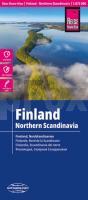
Finnland - Nordskandinavien 1:875.000 Landkarte Reise-Know-How Verlag - world mapping project
EAN / ISBN: 9783831773770
Preis: EUR 12.00
|
|


