 Die Eifel ist ein Paradies für Motorradfahrer. Die Motorradtouren empfehlen wenig befahrene, kurvige steile Straßen durch enge Täler und auf Hochebenen mit tollen Ausblicken. Zentral für Biker ist der Nürburgring, um den herum eigens eine Motorradtour entworfen wurde. Ergänzt werden alle Vorschläge um Ausflugstipps, Sehenswertes, Bikertreffs und Gastronomie sowie Unterkünfte auf der Rückseite der Karte.  Kartenausschnitt Kartenausschnitt
Kartenbeispiel
|
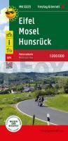
Eifel - Mosel - Hunsrück Motorradkarte mit Ausflugszielen, Einkehr- & Freizeittipps und Tourenvorschlägen, wetterfest, reissfest, abwischbar, GPS-genau. 1:200000 - von - Freytag-Berndt und ARTARIA Publicpress
EAN / ISBN: 9783707922707
Preis: EUR 12.90
|
|


