| << Reisen allgemein: Reiseberichte - Abenteuer |
||
|
||
Zuletzt angesehene Artikel:
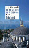
 | Gebrauchsanweisung fĂĽr die TĂĽrkei Ausgezeichnet mit dem ITB BuchAwards 2010, TĂĽrkei - Literarisches Reisebuch - von Iris Alanyali - Piper Verlag |
 | 1070-2 PATRITE Topographische Landkarte 1:25.000 Spanien (Grundlage MTN25) Instituto Geográfico Nacional - CNIG Spanien - ProjektNord |
 | Le Béarn ... à pied - 20 promenades & randonnées - Réf. P641 Topographischer Wanderführer - FFRP (Fédération française de randonnée pédestre) Frankreich |
 | 1221 Handewitt - Gestern und Heute - Historische Ăśberlagerung 1902-1930 Topographische Landkarte 1:25.000 im Vergleich - Landesvermessungsamt Schleswig-Holstein / ProjektNord |
 | Krynica und Umgebung Landkarte 1:50.000 Wanderkarte / Landkarte Okolice Krynicy mapa Rewasz - Polen |
 | 26-111 Topographische Karte 1:25.000 der Tschechischen Republik Zakladnà mapa Ceská republika Cesky urad zememericky a katastralni - ProjektNord |
 | S5223 Mäntyjärvi Topographische Karte 1:25.000 EUREF (Peruskartta) Maanmittauslaitos / Lantmäteriverket Finnland - ProjektNord |
 | OL6 The English Lakes - South-western area - Conston, Ulverston & Barrow-in-Furness - laminierte Wanderkarte GroĂźbritannien 1:25.000 EXPLORER MAP - Ordnance Survey |
 | L243 Geta Topographische Karte 1:50.000 EUREF-FIN (Maastokarttat) Maanmittauslaitos / Lantmäteriverket Finnland - ProjektNord |
| 1968 Rohr Topographische Karte 1:25.000 Messtischblatt des Deutschen Reiches - PreuĂźische Landesaufnahme / Reichsamt fĂĽr Landesaufnahme - Faksimile ProjektNord |
 | Maniitsoq 1:75.000 Wanderkarte Westgrönland - Vandrekort Vestgrønland Greenland Tourism (Blatt 14) |
 | 2222 (NL 32-03-22) Telfs Topographische Wanderkarte 1:50.000 mit Wegmarkierungen - Ă–sterreich - Kartographie BEV - ProjektNord |
 | 2417-IV-SV Topographische Karte Dänemark 1:25.000 Topografisk kort Danmark (DTK/Kort25) 2417-IV-SV ProjektNord - Kort & Matrikelstyrelsen / Geodætisk Institut |
 | L4412 Kaukalampi Topographische Karte 1:25.000 EUREF (Peruskartta) Maanmittauslaitos / Lantmäteriverket Finnland - ProjektNord |
| 14 Canarias occidentales Landkarte 1:500.000 Straßenkarte Spanien - CNIG Centro Nacional de Información Geográfico |
| P.N. MarĂtimo-Terrestre del ArchipiĂ©lago de Cabrera - mapa-guia Wanderkarte 1:25.000 Nationalparks Spanien - CNIG Spanien |
 | 5204 (NL 33-03-04) Nickelsdorf Topographische Wanderkarte 1:50.000 mit Wegmarkierungen - Ă–sterreich - Kartographie BEV - ProjektNord |
 | L3331 Särkisalo Topographische Karte 1:25.000 EUREF (Peruskartta) Maanmittauslaitos / Lantmäteriverket Finnland - ProjektNord |
 | 02-143 Topographische Karte 1:25.000 der Tschechischen Republik Zakladnà mapa Ceská republika Cesky urad zememericky a katastralni - ProjektNord |
 | Da Marina di Sorso a Costa Paradiso (italienisch/englisch) Wanderkarte Sardinien 1:60.000 Carta turistica della Sardegna (7) Edizioni Abies |