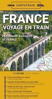
Willkommen bei MapFox
Wurde Ihre Bestellung bestätigt? Wenn nicht - gab es evtl. ein SERVER-Problem! Bitte kontaktieren Sie uns! +++ Buchhändler-Anfragen erwünscht +++
Warenkorb
Artikel: 0 - € 0.00
Zur Kasse
Impressum Kontakt Versandkosten AGB
France - Voyage en train 1:1.550 Mio. Landkarte Cartotrain
<< Frankreich
 
Cover

Übersichtskarte der Eisenbahnlinien in Frankreich.

The first paper map dedicated to train travel in France!

It shows all the stations and railway lines you can travel on - and much more:

- how to take your bicycle depending on the type of train,
- which night train routes operate within France,
- travel times between stations,
- where to find tourist lines and steam trains,
- which stations are listed as historical monuments.
And that’s not all!

The map also includes:

- a detailed overview of all TER fares, tailored for travel across the country’s 13 regions,
- ticket purchasing tips to help you find the best prices,
- an overview of additional connections by boat and coach,
- a topographic background map highlighting nature and terrain,
- a detailed index of around 3,000 stations across the country.

French -English

France - Voyage en train 1:1.550 Mio. Landkarte Cartotrain
EAN / ISBN: 9782959394430
Preis: EUR 14.90

Bestellartikel: versandfertig in ca. 3-7 Tagen. Dieser Artikel wird speziell für Sie bestellt. Keine Rücknahme!
Produkt EUR Anzahl Bestellen
France - Voyage en train 1:1.550 Mio. Landkarte Cartotrain 14.90
Versandkostenfrei in Deutschland ab 30,- Bestellwert

incl. MwSt.

Stichworte, die bei der Suche nützlich sein könnten:
Französische Eisenbahnen Landkarte - Frankreich Eisenbahnkarte - Frankreich - Frankreich Atlanten - Frankreich Karten - Frankreich Kartographie - Frankreich Landkartenverkauf - Frankreich Reiseführer - Frankreich Wanderkarten - Frankreich Radwanderkarten - Frankreich Landkarten - Frankreich Kartografie - Frankreich Radwanderführer - Frankreich Fahrradkarten - Frankreichkarten - Frankreich Straßenkarten - Französische Karten - Französische Landkarten

Zuletzt angesehene Artikel:

CoverFrance - Voyage en train 1:1.550 Mio. Landkarte Cartotrain

Noch kein Cover vorhanden333.41 Amtliche topographische Karte 1:25.000 Polen

Noch kein Cover vorhanden541.3 Amtliche topographische Karte 1:50.000 Polen

Noch kein Cover vorhanden243.4 Amtliche topographische Karte 1:50.000 Polen

CoverVancouver - Granville Island - Victoria 1:15.000 Stadtplan Borch laminiert

Noch kein Cover vorhanden232.1 Amtliche topographische Karte 1:50.000 Polen

Cover105N05 Topographische Landkarte 1:50.000 - Canada - Yukon

Noch kein Cover vorhandenCoquihalla Summit - TOPO (Blatt VCBC16) Topographische Landkarte 1:60.000 - Backroad Topo Map Kanada

Noch kein Cover vorhandenC5902 Prüm Topographische Landkarte 1:100.000 - Landesvermessungsamt Rheinland-Pfalz

CoverRund um Hessisch Lichtenau Topographische Wanderkarte mit Wanderwegen 1:25.000 - ProjektNord

CoverPreili Kreiskarte Lettland 1:100.000 mit Stadtplänen
Preilu Rajons - Jana Seta

Noch kein Cover vorhanden313.41 Amtliche topographische Karte 1:25.000 Polen

Noch kein Cover vorhanden162.32 Amtliche topographische Karte 1:25.000 Polen

CoverAlpenüberquerung Garmisch - Sterzing 7 Etappen mit GPS-Tracks - von Striebig, Thomas - Rother Bergverlag

Noch kein Cover vorhanden172.32 Amtliche topographische Karte 1:25.000 Polen

Cover1345OT CAMBO-LES-BAINS - Hasparren - Topographische Wanderkarte Frankreich 1:25.000 TOP 25 IGN - (GPS)

CoverGebrauchsanweisung für Mallorca - von Wolfram Bickerich - Piper Verlag

Noch kein Cover vorhanden402.4 Amtliche topographische Karte 1:50.000 Polen

Cover12 Strabane - Wanderkarte Nord-Irland 1:50.000 DISCOVERER MAP - Ordnance Survey

Noch kein Cover vorhanden164.2 Amtliche topographische Karte 1:50.000 Polen