Willkommen bei MapFox
Wurde Ihre Bestellung bestätigt? Wenn nicht - gab es evtl. ein SERVER-Problem! Bitte kontaktieren Sie uns! +++ Buchhändler-Anfragen erwünscht +++
Warenkorb
Artikel: 0 - € 0.00
Zur Kasse
Impressum Kontakt Versandkosten AGB
Mercantour - Balades a pied - Les Incontournables Wanderführer (französisch) Chamina - Frankreich
<< Frankreich: Provence
<< Frankreich: Wanderführer - französischsprachig
<< Chamina - Wanderführer (französischsprachig)
 
Cover

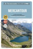
Les 20 itinéraires présentés dans l’ouvrage sont tous situés dans le périmètre du Parc national du Mercantour. À cheval sur 2 départements (Alpes-Maritimes et Alpes-de-Haute-Provence) le Parc du Mercantour est connu pour être l’un des plus sauvages de France, et l’un des plus variés sur le plan des paysages. Les 4 vallées principales du territoire sont visitées : Roya-Bévéra, Vésubie, Tinée et Ubaye.


L`auteur

Olivier Scagnetti, jeune auteur résidant à Saint-Paul-de-Vence (06), diplômé de Sciences-Po, est un passionné de
montagne. C’est son premier livre chez Chamina Édition.


Le guide

? 48 pages
? Format pratique : 12 x 21 cm
? Introduction générale avec présentation du territoire (plusieurs thèmes développés qui enrichissent la connaissance des sites traversés)
? 20 itinéraires de 2h00 à 6h00 pour une pratique familiale et sportive.
? Cartographie sur fond IGN au 1 : 25 000 pour se repérer facilement
? Détail des centres d’intérêts
? Renseignements pratiques pour randonner en toute sécurité
? Adresses utiles

Mercantour - Balades a pied - Les Incontournables Wanderführer (französisch) Chamina - Frankreich
EAN / ISBN: 9782844666253
Preis: EUR 12.90

Bestellartikel: versandfertig in ca. 3-7 Tagen. Dieser Artikel wird speziell für Sie bestellt. Keine Rücknahme!
Produkt EUR Anzahl Bestellen
Mercantour - Balades a pied - Les Incontournables Wanderführer (französisch) Chamina - Frankreich 12.90
Versandkostenfrei in Deutschland ab 30,- Bestellwert

incl. MwSt.

Stichworte, die bei der Suche nützlich sein könnten:
Alpes de Haute-Provence - Seealpen - Provence - Provence Alpes - Mercantour - Alpes-Maritimes - Frankreich Wanderführer - Französische Wanderführer - Chamina Frankreich - Chamina - Frankreich Wanderführer - Provence - Meeralpen

Zuletzt angesehene Artikel:

CoverMercantour - Balades a pied - Les Incontournables Wanderführer (französisch) Chamina - Frankreich

CoverADAC Länderkarte Schweden 1:750.000 - von - MAIRDUMONT

CoverADAC Länderkarte Niederlande 1:300.000 - von - MAIRDUMONT

CoverKöln - Bonn - mit angrenzendem Bergischen Land, Eifel und Siebengebirge - Rother Wanderführer - Bergverlag Rother

Cover175 Southend-on-Sea & Basildon - Wanderkarte Großbritannien 1:25.000 EXPLORER MAP - Ordnance Survey

CoverKambodscha 1:1 Mio. Straßenkarte
Cambodia Travel Map Periplus Editors

CoverUSA-Südost Regionale Straßenkarte 1:2.4 Mio. (Blatt 584) Michelin

Cover174 Bad Tölz 1:35.000 Wanderkarte Fritsch Landkarten-Verlag

CoverSpreewald - mit Ausflug nach Cottbus - Reiseführer -Peggy Leiverkus - Michael-Müller-Verlag

CoverCalifornia State Map - Easy to read Landkarte / Straßenkarte USA Rand McNally

CoverKöln - Bonn ADFC-Regionalkarte 1:75.000 BVA Bielefelder Verlag

CoverRund um Zwiesel - Großer Arber (Blatt 182) 1:25.000 wasserfest - Rad- und Wanderkarte - PhoneMaps - Freytag & Berndt

CoverADAC BundesländerKarte 5 Berlin / Brandenburg 1:300.000

Cover26 Southern Skye & Cuilins LAMINATED Wanderkarte 1:50.000 Großbritannien AA Automobile Association / OS Ordnance Survey Großbritannien

Cover121 Große Fatra Wanderkarte Slowakei 1:50.000 - VKU
Vel`ka Fatra - VKU

Cover60 Große Skitouren Ostalpen Mit GPS-Daten - von Andrea Strauß und Andreas Strauß - Rother Selection - Bergverlag Rother

CoverSchweiz Wanderführer die 50 schönsten Wanderungen - Kümmerly + Frey

CoverArgentinien (Blatt 11) 1:2 Mio. Straßenkarte
Rutas de la Argentina - Mapa Carretero AutoMapa

CoverDUMONT Reise-Handbuch Dänemark von Klüche, Hans DuMont Reisehandbuch

CoverCastrop-Rauxel Nord 1944 1:19.000 (Blatt 12) Alte Stadtpläne des Ruhrgebiets
Old maps of the Ruhr Alan Godfrey Maps