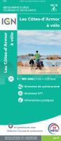
| << Frankreich: Radwanderkarten und Radwanderführer |
  | |
Zuletzt angesehene Artikel:
![]() | Côtes-d`Armor à vélo - Découverte à Vélo Touristische Karte TOP Vélo 1:100.000 (wasserfest) IGN Frankreich |
![]() | 179 Canterbury & East Kent - Dover & Margate - Wanderkarte Großbritannien 1:50.000 LANDRANGER MAP - Ordnance Survey |
![]() | Montenegro - Porgorica mit Wanderwegen und Radwegen - Wanderkarte - Fahrradkarte 1:75.000 Montenegro - ProjektNord |
![]() | 3523 Garbsen Amtliche topographische Karte 1:25.000 Landesvermessungsamt Niedersachsen |
![]() | 4153 Jänischwalde (Groß Gastrose) Topographische Karte 1:25.000 Landesvermessungsamt Brandenburg (gefaltet) |
![]() | 3230 Wittingen Topographische Wanderkarte 1:25.000 Niedersachsen mit Wanderwegen - ProjektNord |
![]() | N-34-105-C/D Rutki - Kossaki Amtliche topographische Landkarte Polen 1:50.000 N-34-105-C/D Rutki - Kossaki - Mapa Topograficzna Polski Glowny Geodeta Kraju |
![]() | 1221SB GUEMENE - PENFAO - NOZAY GPS Amtliche Topographische Wanderkarte Frankreich 1:25.000 - série bleue (IGN) |
![]() | 3630 Wolfsburg Süd Amtliche topographische Karte 1:25.000 Landesvermessungsamt Niedersachsen |
![]() | S41 Topographische Karte 1:100.000 EUREF-FIN Maanmittauslaitos / Lantmäteriverket Finnland - ProjektNord |
![]() | Madonie a piedi - 24 itinerari escursionistici nelle `Alpi di Sicilia`. Touristischer Wanderfürher (Italienisch) - Anselmo V |
![]() | M32 Topographische Karte 1:100.000 EUREF-FIN Maanmittauslaitos / Lantmäteriverket Finnland - ProjektNord |
![]() | Kiel, Rendsburg, Neumünster 1:70.000, (Nr. 3355) Fahrradkarte. GPS-genau. 1:70.000 (wasserfest) KOMPASS-Karten |
![]() | Naher Osten Laminierte PLANO-Karte 1:6.087 Mio. (Format: 77 x 60 cm) - gerollt im Plastikrohr Middle East flat map - laminated National Geographic |
![]() | 122 Skegness & Horncastle - Wanderkarte Großbritannien 1:50.000 Active Laminiert LANDRANGER MAP - Ordnance Survey |
![]() | P31 Topographische Karte 1:100.000 EUREF-FIN Maanmittauslaitos / Lantmäteriverket Finnland - ProjektNord |
![]() | 187 N Porsangmoen NORD 1:50.000 - Amtliche Topographische Landkarte Norwegen - Startens Kartverk |
![]() | L6326 Kitzingen (geplottete Ausgabe) Topographische Karte Bayern 1:50.000 Bayerisches Landesvermessungsamt |
![]() | Walking in the Southern Uplands - The best hill days in southern Scotland Wanderführer Schottland - Cicerone Großbritannien (englisch) |
![]() | 3535OTR NEVACHE / MONT THABOR - Cols du Galibier et du Lautaret - Topographische Wanderkarte Frankreich 1:25.000 (LAMINIERTE AUSGABE) TOP 25 IGN - (GPS) |


